






Another sizzling weekend is in store for the UK as temperatures continue to heat up in a “truly historic spell of May weather,” the Met Office said.
This week, temperatures shattered records as Kew Gardens reached 35.1°C on Monday, exceeding its previous station record of 29.3°C and the previous UK May record of 32.8°C.
Counties including Oxfordshire, Surrey, Bedfordshire and Cambridgeshire all saw stations record new maximum records well into the low and mid-30s. In total, 163 stations broke their May maximum temperature records, the Met Office said.


Saturday will continue to deliver sunshine as temperatures are set to climb as high as 29C, with plenty of sunshine expected across England and Wales.
About this week’s heatwave, the Met Office said: “What makes this event particularly noteworthy is the combination of very high daytime temperatures and persistently warm nights.
“Typically in Spring, even during warm spells, overnight temperatures fall sufficiently to provide some relief. In this case, that cooling was limited across many parts of the UK.”

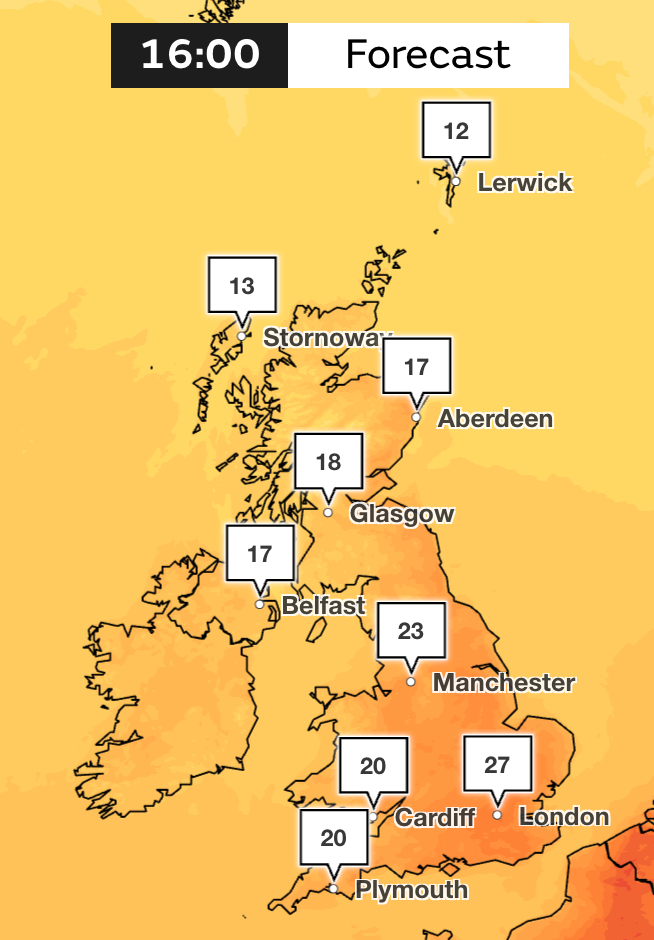
The story is slightly different for Northern Ireland and western Scotland as the weekend will begin with “a much wetter spell”, Met Office meteorologist, Aiden McGiven, said.
But temperatures will still be mild as the mercury simmers in the late teens, with highs of 18-20C across many parts of the two regions.
Mr McGiven said: “Sunday will be notably different for England and Wales, with showers across Wales, northern and western England.
“It will be driest towards the southeast, with temperatures reaching the low 20s. Scotland and Northern Ireland will not be as wet as Saturday, but changeable with a keen breeze, a lot of cloud and some showery rain.”

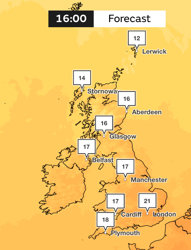
Met Office forecast
Tonight:
Evening showers slowly clearing eastwards. Cloudy with outbreaks of rain affecting parts of Northern Ireland and Scotland, otherwise dry with clear spells. Another warm night, especially in the east.
Friday:
Dry with sunny spells for most, however outbreaks of rain will affect the far north, with showers across the southeast, where it will be another very warm day. Cooler elsewhere.
Outlook for Saturday to Monday:
A band of rain then gradually spreading eastwards over the weekend introducing some fresher and showery conditions. Another band of rain likely to push eastwards on Monday. Near normal temperatures.