


Britain’s summer is off to a stormy start despite marking the sunniest and warmest spring on record.
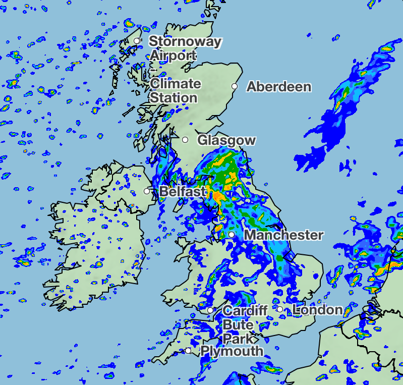
The Met Office has forecasted blustery showers and heavy rain with occasional hail and thunder from the start of June.
While temperatures look to remain mild and balmy at in the mid- to high-teens, it’s a marked difference from the sky-high temperatures of May, after the month started with peaks of 29.3C in London. Scotland will see 13C on Thursday, while further south in England, London will experience temperatures of 19C.
Meteorologist Clare Nasir said there would be “more wet weather on its way into the early hours of Thursday morning”, adding that “the rain then gradually tracks towards eastern counties through the morning. A stronger wind, particularly across channel coasts and some showers to follow.”
She said: “This band of rain will mean some wet weather through the first part of Thursday.”

The forecaster warned that hail and thunder are possible over the weekend as well while the weather remains wet.
The latest downpour comes as Britain marked record-breaking weather for April and May, with the Met Office declaring the warmest and sunniest spring on UK record on Monday.
All across the UK, the Met Office marked the warmest spring for mean temperatures since the series began in 1884, surpassing the previous record from 2024. Northern Ireland, Scotland and Wales also saw their sunniest spring on record, while England recorded its second sunniest spring since records began in 1910.
Spring 2025 has been classed as the fourth sunniest season overall for the UK, with only three summers sunnier since records began.

The Met Office put the unusual spring weather down to persistent high-pressure systems originating from mainland Europe, which have blocked the usual flow of Atlantic weather fronts.
Met Office scientist Emily Carlisle said: “The UK’s climate continues to change. What’s particularly notable about spring 2025 is the combination of record warmth and sunshine, alongside very low rainfall.
“This spring shows some of the changes we’re seeing in our weather patterns, with more extreme conditions, including prolonged dry, sunny weather, becoming more frequent. The data clearly shows that recent decades have been warmer, sunnier, and often drier than the 20th century average, although natural variation will continue to play a role in the UK’s weather.”
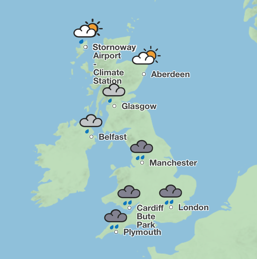
UK weather forecast
Wednesday:
Sunny spells and showers for many, these locally heavy and frequent in the north. Showers forming into bands across Northern Ireland, southern Scotland, and northern England. Breezy for all, with coastal gales in northwest Scotland at first. Feeling cool.
Blustery showers continue to affect the north of the country tonight. Dry with clear spells elsewhere, but thicker cloud and outbreaks of rain arriving from the west later.
Thursday:
Rain, heavy in places will push eastwards during the day, clearing by mid afternoon. Sunny spells and showers, already affecting Scotland will follow for all. Rather breezy.
Friday to Sunday:
Staying changeable with sunny spells and showers on Friday. Heavier and more frequent showers on Saturday, with hail and thunder possible. Drier on Sunday. Often breezy and feeling rather cool.

.png?trim=0,300,0,0&width=1200&height=800&crop=1200:800 "Australian bouncy castle operator acquitted in accident that killed six children – UK Times")

