


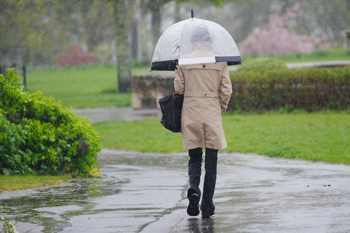
Britons hoping for a sunny Bank Holiday weekend might be sorely disappointed as forecasters warn of heavy rain, strong winds and colder temperatures across the UK, with thunder even set to hit some places.
Following one of the warmest springs on record and the driest start to the season seen for nearly six decades, the Met Office said the weather in the UK is finally turning this week.
The forecaster said the country has already seen the end to the long dry spell, with rain hitting the south on Wednesday. Met Office meteorologist Dean Hall said even single and multicell thunderstorms broke out across parts of the West Midlands, South East England and central southern England.
Meanwhile, Saturday, Sunday and Monday are expected to see a “marked change in weather type”, with many areas seeing rain or showers and more unsettled conditions, which are predicted to remain into next week.
It comes as the high pressure that has been dominant for much of the last few weeks is expected to finally move away eastwards this weekend, as Deputy Chief meteorologist David Oliver explained: “We’ll see a change in conditions this weekend as weather systems move in from the Atlantic.

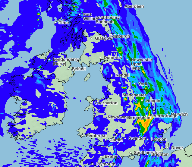
“These will bring rain and windier conditions from the west later Friday, which will spread across the whole of the UK on Saturday. Some heavy rain is expected, especially in the northwest later on Saturday when winds will also strengthen, bringing a risk of coastal gales in the north.
“These strong winds will continue on Sunday as an area of low pressure passes the northwest of the UK. Blustery showers are expected on Sunday, which will be heaviest and most frequent in the northwest. Conversely, the south and southeast may well see a good deal of dry weather. Wind will be a watchpoint for Sunday, especially across Scotland where there is some uncertainty on the exact track of the low and its associated wind speeds, so keep up-to-date with the forecast as it evolves over the coming days.”
The “unsettled” weather continue into Bank Holiday Monday, according to the Met Office, with a mix of blustery showers and bright spells set to hit the UK.
Some Britons are warned to brace for heavy and thundery showers in places, especially in parts of the northwest. Temperatures, meanwhile, are forecast to be near or a little below average, which will feel rather cool when compared to the balmy weather in recent weeks.

And next week is also set for more “unsettled” conditions, with many areas warned of rain but mixed with drier spells.
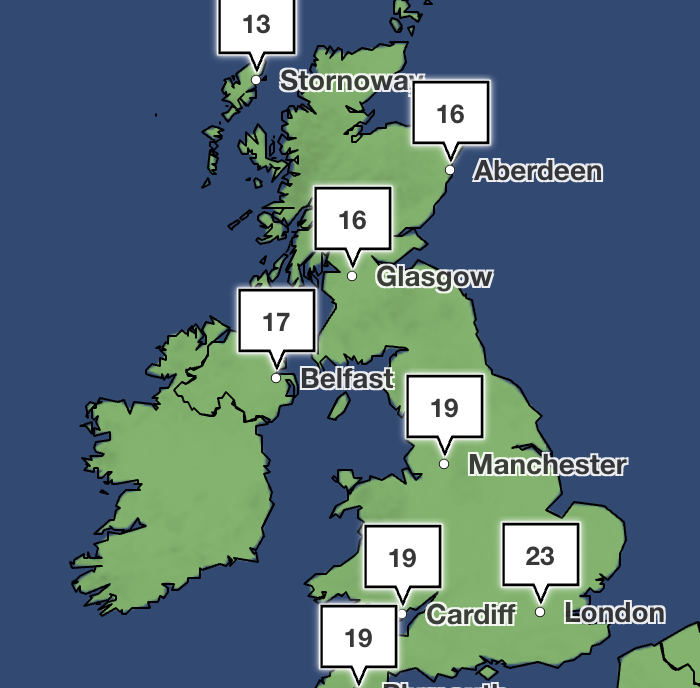
However, Britons can expect a hot half-term week, with temperature climbing to above average. Some parts of the south of the country are forecast to enjoy 23C at times. The Met Office added that temperatures will likely remain close to average.
And Friday is expected to be “mostly fine” before the weekend brings its expected wet and windy weather.
“A real change from what we’ve become used to so far this spring,” Met Office meteorologist Alex Burkill said.

