


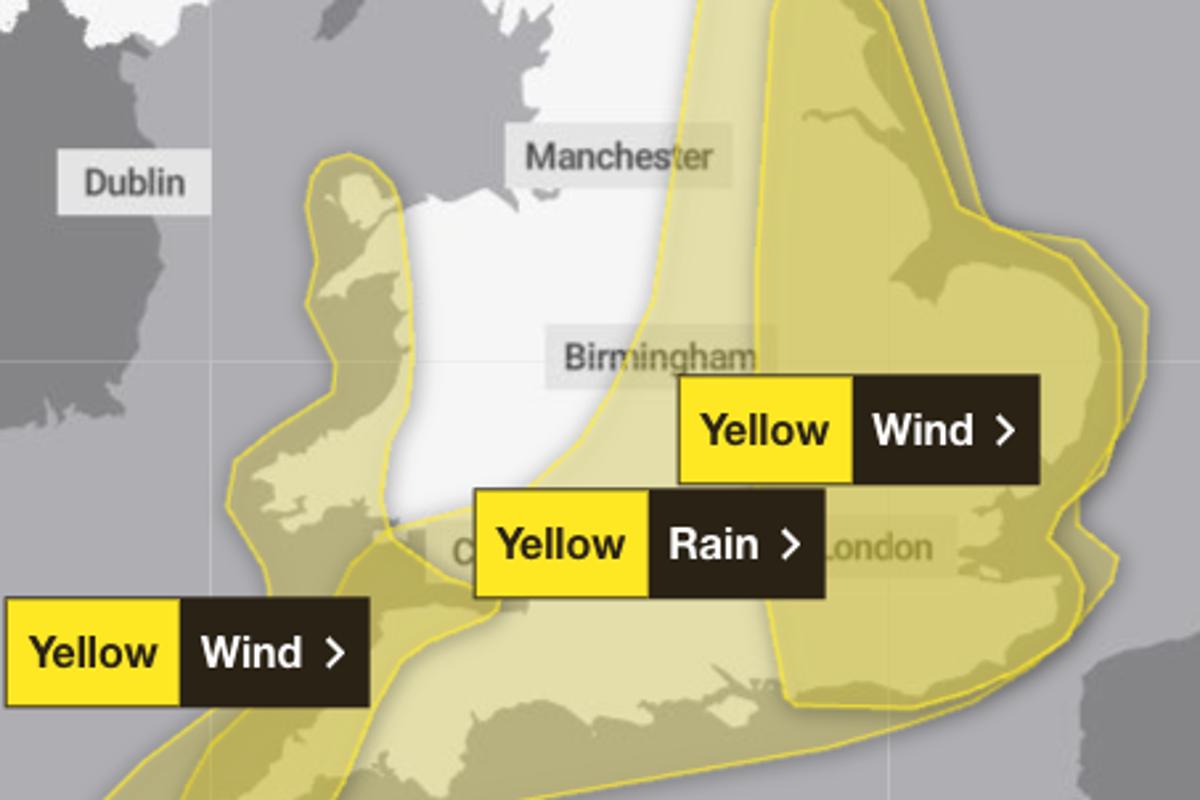
The Met Office has issued yellow weather warnings across large swathes of the UK for high winds and heavy rain.
Forecasters have warned that eastern parts of England are set to be hit with gusts of wind up to 75mph on Thursday, which could trigger power cuts and pose a “danger to life” from large waves and beach material being thrown onto sea fronts, coastal roads and properties.
The Met Office warned: “Gusts of wind of 45 to 55mph can be expected widely, with 65mph possible near coasts. There is a smaller chance that wind gusts of 65 to 75mph may develop for a time very locally, this most likely late morning and into the afternoon.”
To avoid injury from flying debris or property damage, the Met Office suggests checking for loose items outside the home such as bins, garden furniture, trampolines, tents, sheds, and fences.
The yellow warning for wind stretches from Brighton, London, Oxfordshire and Norwich up to Hull and York from midnight to 9pm.

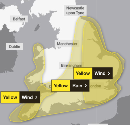
A separate weather warning for winds of up to 60mph across Cornwall, Devon, Somerset and parts of west Wales, including Swansea, Pembrokeshire and up to Anglesey, has also been issued by the Met Office for between 4am and 6pm on Thursday.
Heavy rain is also forecast across the south and east of England and some parts of south Wales, which could cause flooding of homes and businesses, the Met Office has warned.
Some areas could see as much as 50mm of rain on Thursday morning, especially in the South West, forecasters said.
“There is a small chance a few places could exceed this, most likely over North Devon and Cornwall and more generally in the east of the highlighted area,” the Met Office said.
“Conditions are expected to turn windy with a chance of gales, initially along southern and eastern coasts, but more widely across southern Britain during Thursday daytime.”
The yellow weather warning for heavy rain covers Cornwall and Devon in the South West, south Wales including Swansea and Cardiff, large parts of the Midlands, the North East including Darlington, and as far South East as Kent.
The strong wind and rain may cause travel disruption, such as longer journey times or cancellations, if road, rail, air and ferry services are affected.
It comes after Storm Amy caused widespread disruption earlier this month across the UK and Ireland, leaving thousands of homes without power and forcing the closure of parks, railway lines, and ferry routes as winds of up to 100mph hit parts of the country.
UK five-day weather forecast
Tuesday:
A day of sunny spells and scattered showers. Showers heaviest and most frequent in the North West, where it will also be rather breezy. Feeling pleasant in any sunnier periods, particularly towards the South East, where temperatures will be above average.
Tuesday night:
Mostly dry through the evening and overnight, with clear spells. A few showers still possible, mainly towards the North West. Turning chilly, with some mist and fog patches forming.
Wednesday:
Mist and fog patches clearing to leave a dry day for many, with sunny spells and just a few showers. Turning wet and windy in the South West come late afternoon.
Thursday to Saturday:
Potentially wet and very windy on Thursday, but clearing to sunshine and showers by Friday. Colder Saturday with further scattered showers, these wintry over the Scottish mountains.


