






Tropical Storm Bertha made landfall in southern Louisiana on Wednesday, bringing strong winds and widespread closures across the Gulf Coast. The slow-moving storm, which had already prompted beach closures from the Florida Panhandle to Mississippi, touched down in St. Bernard Parish, approximately 40 miles (65 kilometers) east of New Orleans.
The National Hurricane Center reported Bertha’s maximum sustained winds at 45 mph (72 kph) at the time of landfall. Forecasters anticipate the storm will maintain this intensity as it tracks towards the upper Texas coast by Thursday.
Authorities issued a tropical storm warning stretching from Alabama to Louisiana, encompassing New Orleans, where residents were already contending with extreme heat. Parks, piers and some low-lying roads were shut down along the coast as wind and storm surge posed the primary threats to the Deep South states.

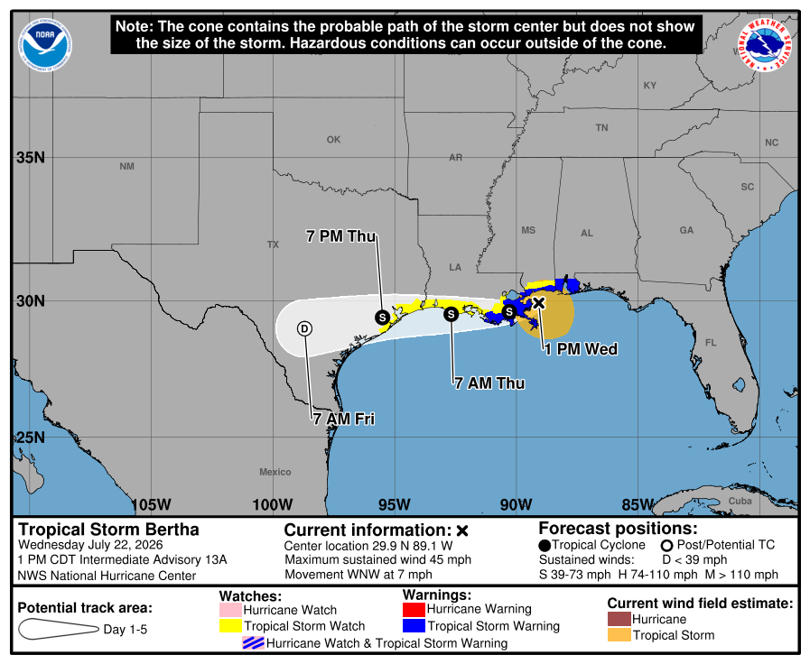
By Thursday evening, the storm’s center was located about 40 miles (70 kilometers) southwest of New Orleans.
Onlookers watched the storm surge at the Lake Pontchartrain estuary, with kids splashing in the floodwaters as Bertha approached the Louisiana Coast. Residents mowed their lawns even as streets filled up with water.
Tropical storm force winds were felt as much as 160 miles (260 kilometers) from the center of the storm, the National Hurricane Center said. A wind gust of 44 mph (71 kph) was recorded at New Orleans Lakefront Airport on Wednesday afternoon.
The strong gales knocked over a Waffle House sign onto a car in Panama City Beach, Florida.
But the heaviest rains were staying offshore, reducing the risks of flooding, the center said.
The storm is unlikely to leave behind widespread damage, Louisiana State Climatologist Jay Grymes said. The impact should be manageable for coastal communities, he said.

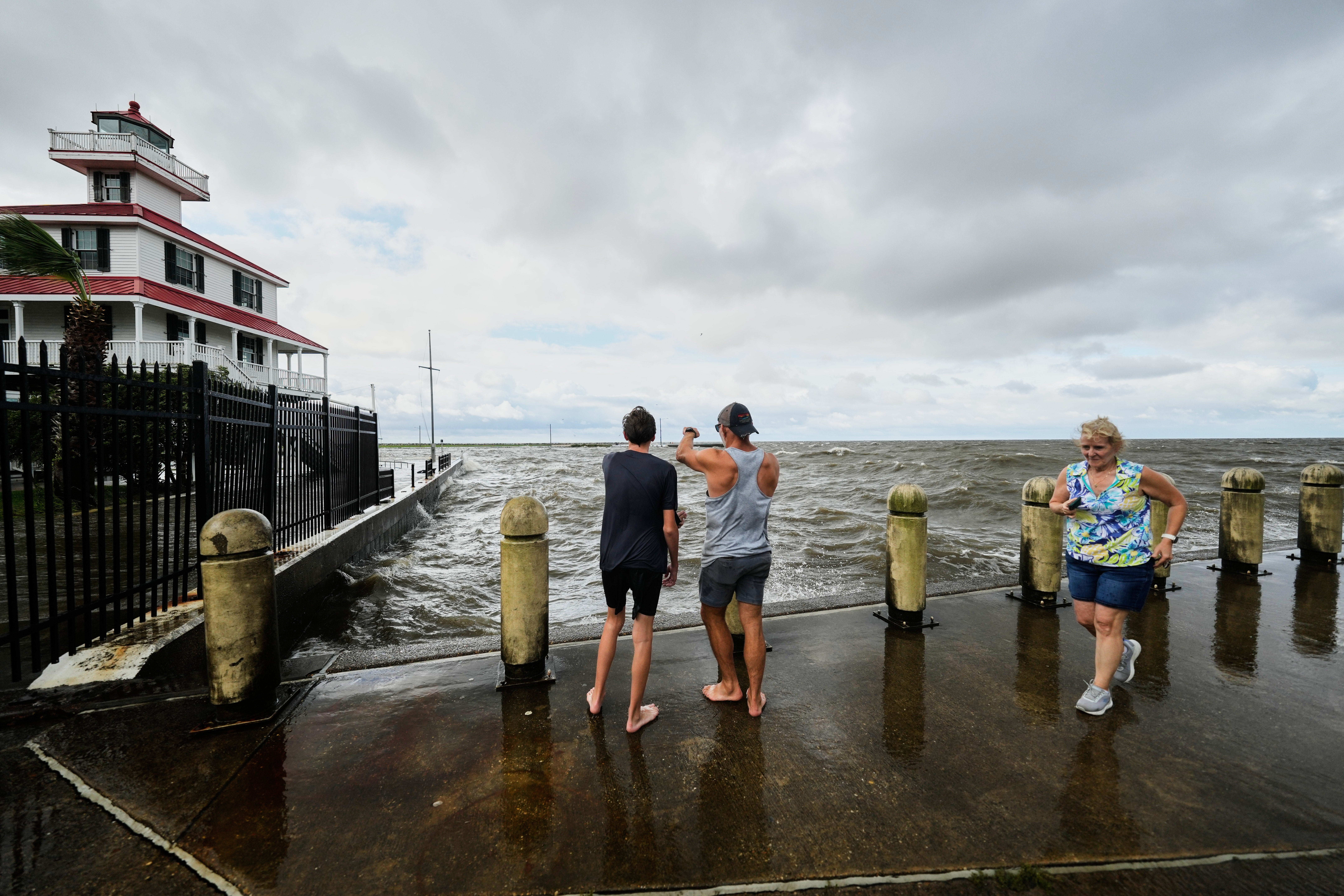
Gov. Jeff Landry called the forecast “encouraging” but also warned residents to be prepared for some flooding.
Storm surges up to 3 feet (1 meter) were possible in Louisiana and Alabama, forecasters said. Rain totals were forecast between 1 and 4 inches (3 to 10 centimeters), with higher amounts possible in isolated areas.
Bertha is expected to dissipate inland in Texas by Friday, the hurricane center said.
Bertha is expected to continue losing strength over the next few days as it heads toward Texas after the storm earlier trudged past the Florida Panhandle and the tips of Alabama and Mississippi. At landfall, the storm’s maximum sustained winds were around 45 mph.
Elsewhere in the U.S. this week, a line of storms generated reports of tornadoes stretching from Cincinnati to New Jersey. Torrential rains caused flash floods Tuesday night that swamped homes, washed out bridges and led to water rescues in West Virginia, authorities said.
Sandbag distribution sites are set up
Authorities in Mississippi, Louisiana and Florida opened sites to provide sandbags to residents who may be impacted by Tropical Storm Bertha. Double-red flag warnings were posted along some beaches, closing them to swimmers.


“For locals, this is just another storm,” said Candice Henderson, manager of the Crab Trap, a beachside restaurant that was packed Tuesday on Pensacola, Florida’s Perdido Key. “When you’re on vacation and it’s raining, you either shop or you go out to eat.”
Bertha is the second tropical storm of the Atlantic hurricane season. Tropical Storm Arthur in June brought heavy rainfall to the southeastern U.S.

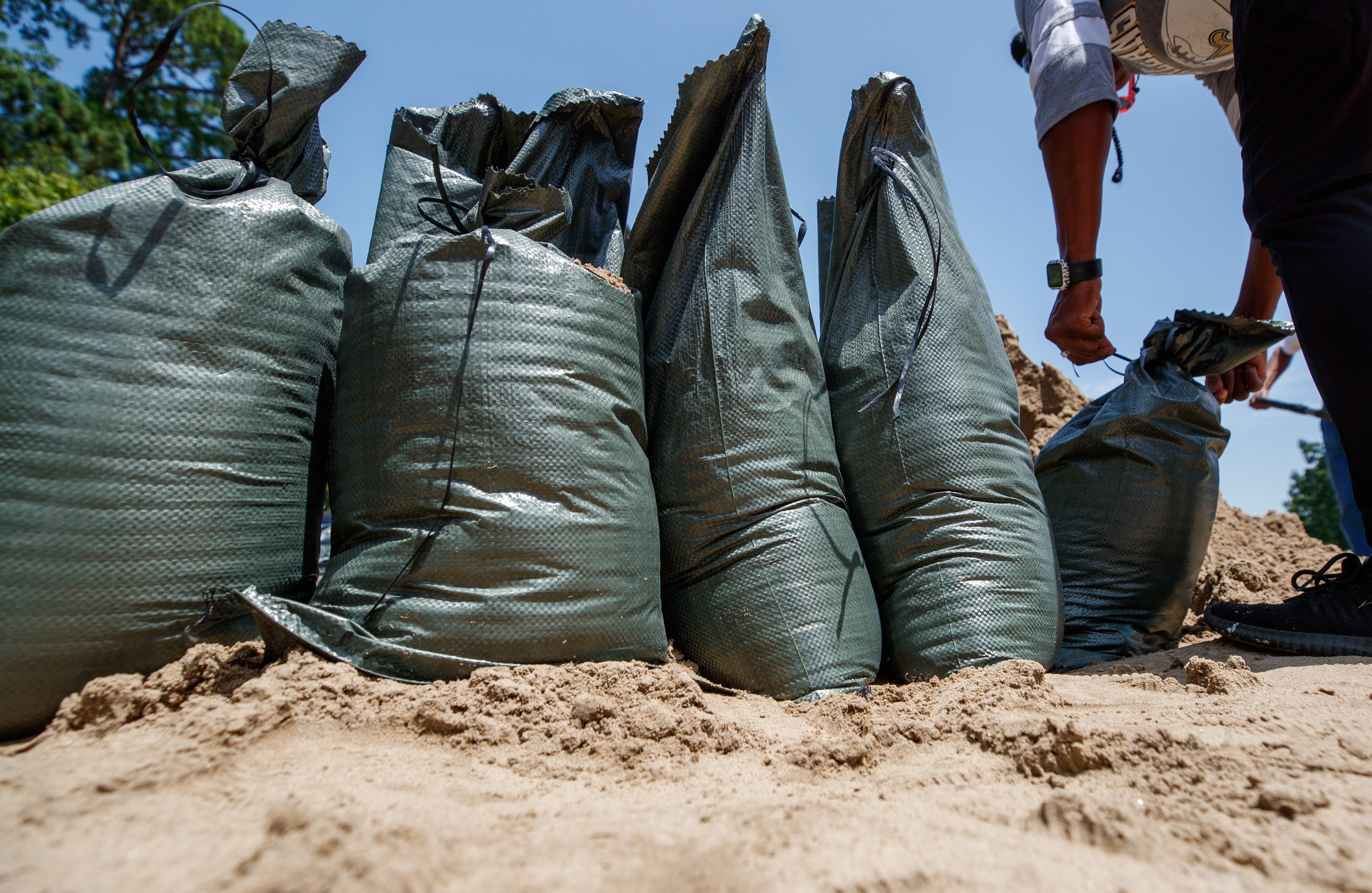
Bertha could dump heavy rain on coastal areas of Mississippi that are still recovering from flooding brought by Arthur that destroyed and damaged homes.
Hurricane Fausto in the Pacific is far from land
In the eastern Pacific Ocean, Hurricane Fausto churned far from land Wednesday. The hurricane was hundreds of miles west-southwest of the southern tip of Baja California with maximum sustained winds of 80 mph (130 kph).
It was forecast to gradually strengthen and the hurricane center warned that ocean swells generated by Fausto could cause life-threatening surf and rip tide conditions on the Baja California coast.


