


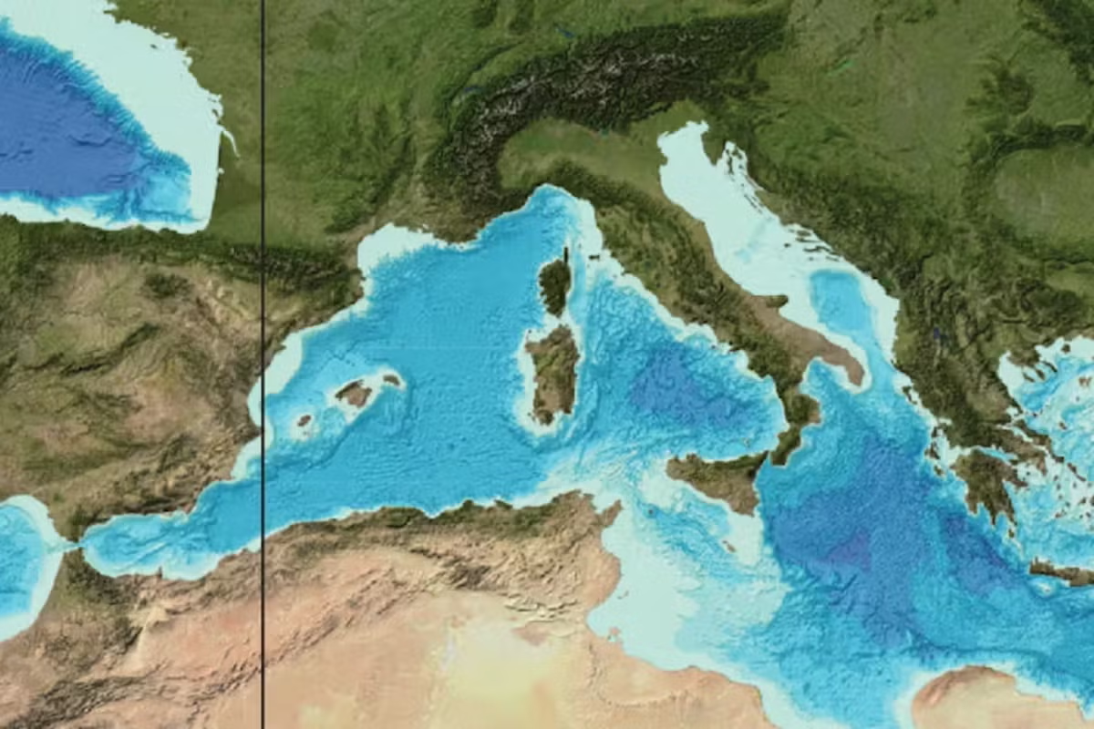
A little over 5 million years ago, water from the Atlantic Ocean found a way through the present-day Strait of Gibraltar. According to this theory, oceanic water rushed faster than a speeding car down a kilometre-high slope towards the empty Mediterranean Sea, excavating a skyscraper-deep trough on its way.
The Med was, at the time, a largely dry and salty basin, but so much water poured in that it filled up in just a couple of years – maybe even just a few months. At its peak, the flood discharged about 1,000 times the water of the modern-day Amazon river.
At least, that’s the thesis one of us put forward in a 2009 study of an underwater canyon excavated along the Strait of Gibraltar, which he presumed to have been carved out by this massive flood. If correct, (and some scientists do dispute the theory), the so-called Zanclean megaflood would be the largest single flood recorded on Earth.
But extraordinary claims like this require extraordinarily solid evidence. Our latest research investigates sedimentary rock from the Zanclean era that seems to record how the water surged through a gap between modern-day Sicily and mainland Africa to refill the eastern half of the Mediterranean.
How scientists tracked down the megaflood
Our finding is the latest twist in a story that began in the late 19th century. That’s when geologists studying salt-rich rock outcrops around the Mediterranean became increasingly aware that something unusual had happened between roughly 5 and 6 million years ago, well before the glaciations of recent ice ages: the sea had dried up. They named that age “Messinian” and the drying up eventually became known as the Messinian salinity crisis.
In the 1970s, scientists for the first time drilled deep below the Mediterranean into sedimentary rocks from the Messinian age. They made three surprising discoveries. First, they found a massive layer of salt – kilometres thick – below much of the seafloor. This confirmed that a vast environmental change had happened about 6 million years ago, just when tectonic plates shifted and the sea became largely isolated from the Atlantic Ocean.
Second, right above this salt layer, they found sediment with fossils from shallow, low-salt lakes. This suggested that the Mediterranean Sea dropped to more than a kilometre below today’s level, and as most of the water evaporated, salt was left behind. A series of lakes would have remained in the lowest parts of the basin, refreshed and kept relatively salt-free by streams. This interpretation was also supported by seismic surveys of the seabed which revealed rivers once cut through a dry landscape.
And third, the rocky layers above the salt abruptly shifted back to more typical deep sea sediment. (We now know that less than 11% of Mediterranean marine species survived the crisis, showing just how big and lasting the impact was on life in the sea). The term Zanclean Flood was coined in the 1970s to refer to the end of the crisis, without scientists really knowing what it consisted of or the timescale taken to refill the dry Mediterranean basin.
The next breakthrough came in 2009, when geophysical data for the planned Africa-Europe tunnel through Gibraltar suggested that a huge underwater trench between the Atlantic Ocean and the Mediterranean Sea must have been created by a sudden and cataclysmic flood.

Our latest research backs up this hypothesis. As part of a team led by Maltese seabed scientist Aaron Micallef, we explored the region where the flood water filling the western basin of the Mediterranean should have run into a ridge of higher land connecting modern-day Africa and Italy, known as the Sicily Sill. Was there any evidence, we wondered, of a second megaflood as the eastern Mediterranean filled up?
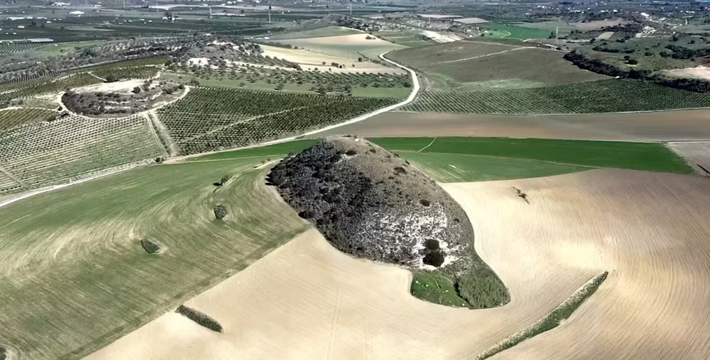
Giovanni Barreca, one of our co-authors on the recent paper, grew up in southern Sicily. He long ago realised that the low hills near the coast are an extension of the Sicily Sill over which the megaflood must have progressed from west to east. The area, he thought, might contain clues.
Our team visited this part of Sicily and noticed that the hills were indeed unusual. Their aligned and streamlined shapes separated by deeply eroded depressions are very similar to streamlined hills in Washington state in the US. Those Washington hills were carved out by a megaflood at the end of the last Ice Age when the vast Lake Missoula dammed up behind a glacier and emptied catastrophically.
If those hills and depressions in Sicily were also shaped by a huge flood, then rock debris eroded from the base of the depressions should be found dumped on top of the hills, more than 5 million years later.
Sure enough, we did find jumbled and contorted rock debris up to boulder size along the crest of the hills. They were the same types of rock found within the depressions as well as further inland.


To double check our work, we developed a computer simulation (or “model”) of how flood waters might have crossed one part of the Sicily Sill. It showed that the flood flow would indeed mimic the direction of the streamlined hills.
In fact, the model showed that the hills would have been carved out by water 40 metres or more deep, travelling at 115 kilometres per hour (71mph). In the one area we modelled, 13 million cubic metres of water per second would have flooded into the eastern Mediterranean basin (for reference: the Amazon today is about 200,000 cubic metres per second). Remarkably, this is still only a fraction of the water that first flowed through Gibraltar and then into the eastern Mediterranean basin near Sicily.
Daniel García-Castellanos is an Earth scientist at Instituto de Geociencias de Barcelona (Geo3Bcn – CSIC).
This article is republished from The Conversation under a Creative Commons license. Read the original article.

