


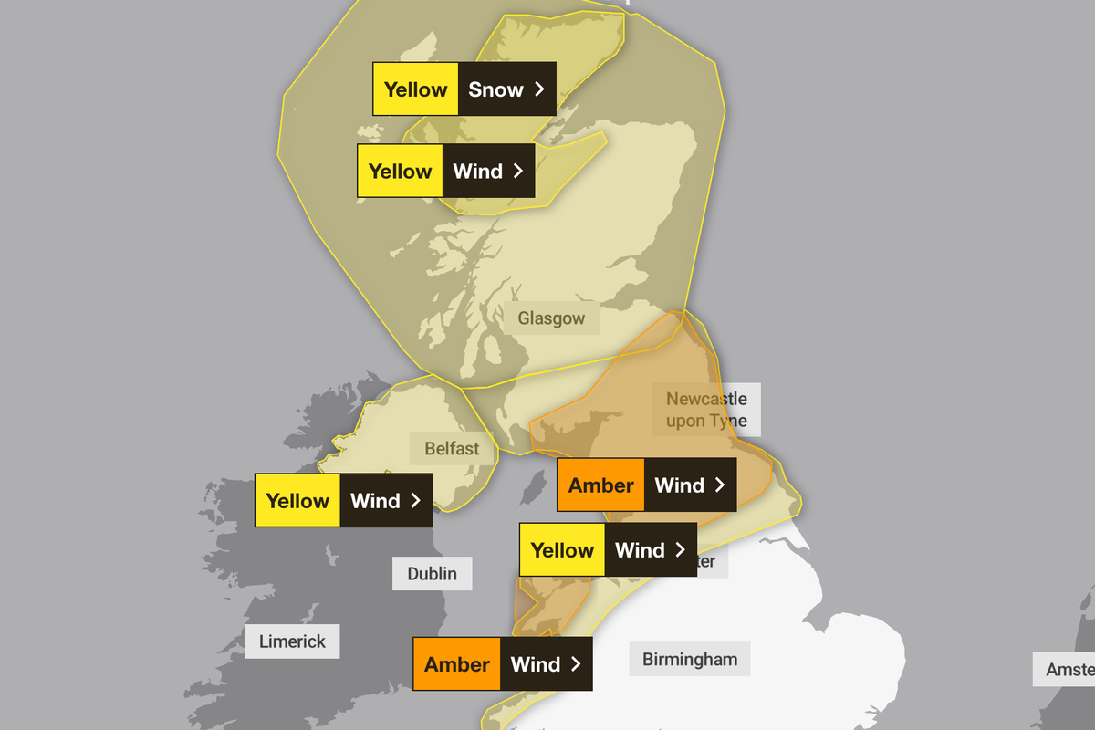
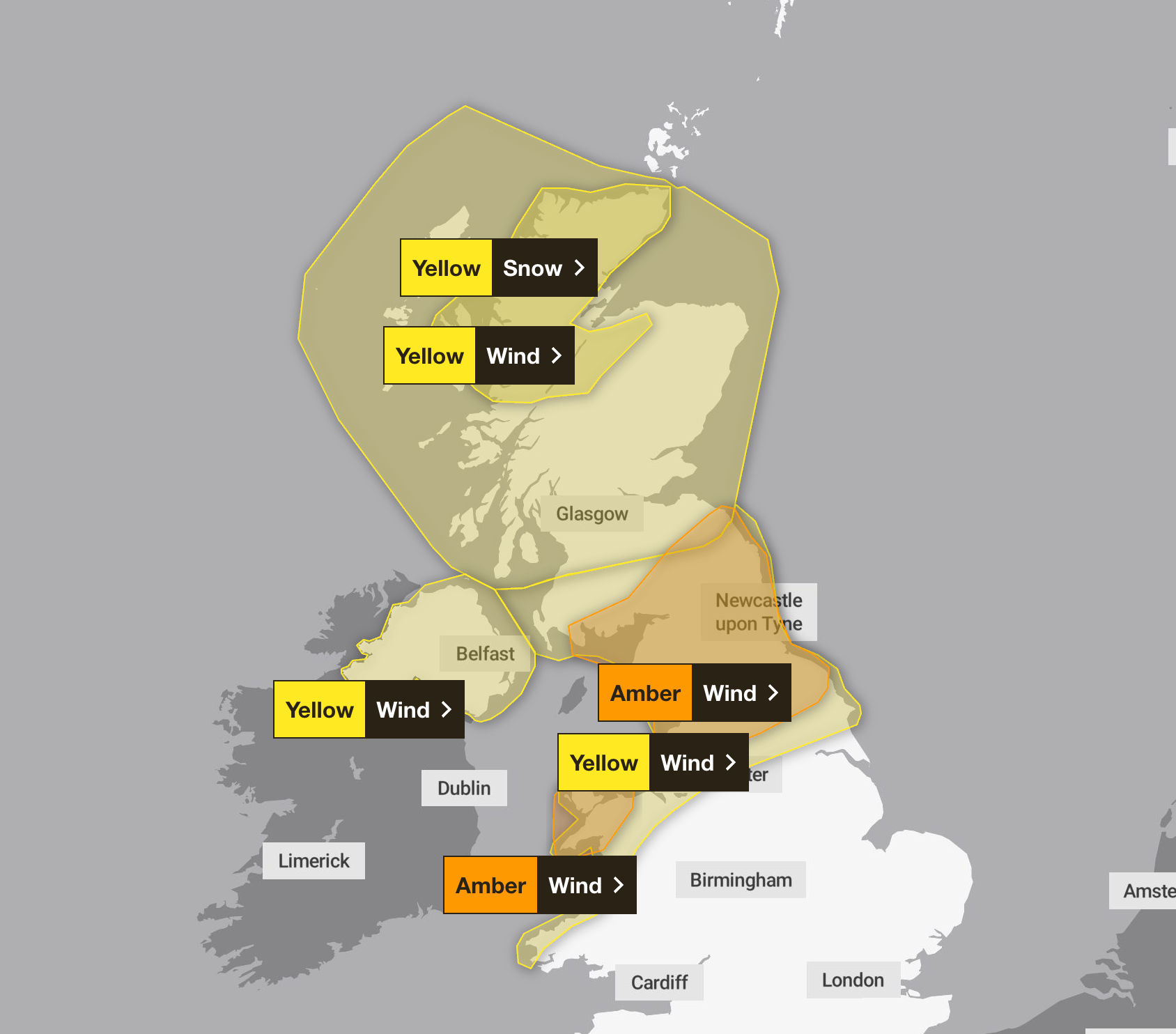
The Met Office has warned Storm Dave will “continue to deepen” as it brings heavy snow and strong gusts to northern parts of the country.
Gusts of up to 70mph are expected to hit northern England, southern Scotland and northwest Wales – what the Met Office has called “disruptive and potentially damaging winds”.
Coastal areas covered by the amber weather warning could see wind speeds reach 80mph.
The Met Office warned there is a risk of power cuts, travel disruption and difficult conditions along coastal areas, with the weather warning is in place until 3am on Sunday. Flying debris and large waves could result in injuries and danger to life, it added.
Yellow warnings for wind and snow are also in place across a broader area of northern England Scotland and Northern Ireland as Storm Dave moves eastwards across the UK, bringing a spell of wet and windy weather.

Met Office chief meteorologist, Chris Bulmer, said: “Storm Dave will bring a period of very strong winds, with the strongest gusts most likely in the Amber warning area. People should be prepared for impacts with disruption to travel likely and possible power cuts.”
“Wind speeds will peak at different times as the deep area of low pressure moves across the north of the UK.”
The Met Office warned that being outside during strong winds makes people vulnerable injury, urging the public to “stay indoors as much as possible”.
It said: “If you do go out, try not to walk, or shelter, close to buildings and trees. In advance of high winds, check for loose items outside your home and secure them. Items include; bins, garden furniture, trampolines, tents, sheds, and fences.”


In northern Scotland, heavy snow of 5-10cm is likely to fall at some locations over 200m.
Some areas could see 10-20cm and with strong wind blizzards and drifting snow will be an additional hazard. A yellow weather warning for snow has been issued until 3 am on Sunday covering parts of northwest Scotland.
RAC spokesperson Rod Dennis said: “The arrival of Storm Dave is set to make driving conditions across the north and west of the UK this Easter particularly challenging. While we expect leisure traffic volumes to be slightly lower on Saturday and Sunday compared with the rest of the bank holiday, there will still be millions of people on the roads visiting friends and family.
“Drivers shouldn’t underestimate the impact of the very strong winds that are forecast. We recommend taking extra care on exposed, higher routes and being especially cautious when overtaking high‑sided vehicles, as the buffeting effect can catch some people out. Slowing down and keeping a firm grip on the steering wheel are both vital in these conditions.”
Weekend weather forecast
Sunday:
Cloud, rain and hill snow across the far northeast clearing, as winds continue to ease. Sunny spells and blustery showers for many, but southern areas may to stay dry. Chilly.
Monday:
Winds will ease as Storm Dave clears into the North Sea on Sunday. Blustery showers will continue across Scotland and Northern Ireland while much of England and Wales will become fine.
Easter Monday will be the driest day of the Easter weekend, with a ridge of high pressure in the wake of Storm Dave bringing a more settled day. Most areas will see some sunny spells after a chilly night.


