


For the first time, residents and visitors can enjoy the new 28-mile (45km) stretch of the King Charles III England Coast Path on the Isle of Sheppey, in north Kent.
The route, more than 80 per cent of the island’s total coast path, was opened by Natural England today. This section becomes part of what will be the world’s longest managed trail when all 2,700 miles are joined up.
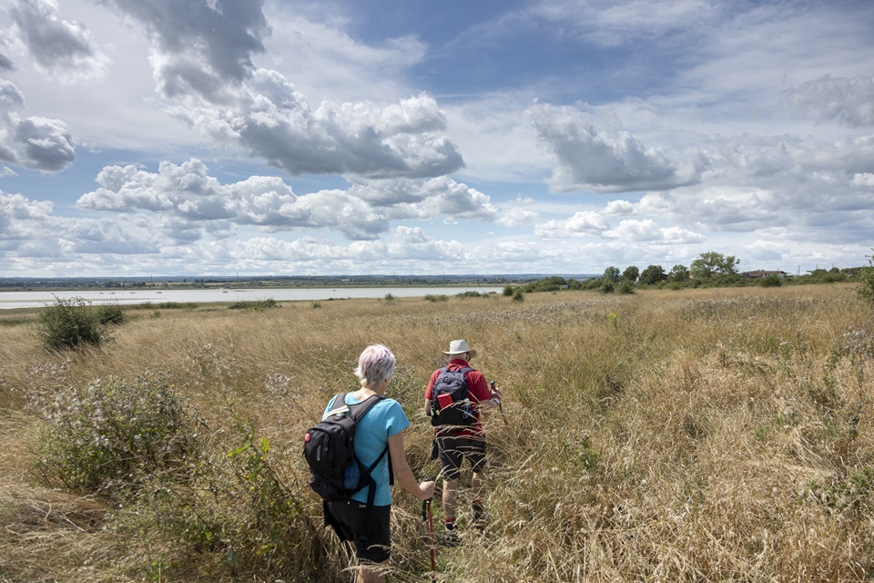
The easy-to-follow path, which has stunning views across the Swale and Medway estuaries, takes you through grazing land, the picturesque historic harbour of Queenborough and 2 National Nature Reserves.
James Seymour, Natural England deputy director for Sussex and Kent, said
It’s really exciting that this stretch of the King Charles III England Coast Path is open on the Isle of Sheppey for local residents and visitors to enjoy.
With its summer breeding and winter migratory birds, and far-reaching views across the Swale Estuary, it is a haven to experience.
We know the health and wellbeing benefits of connecting with nature, and this path should also benefit the local community as walkers pass the businesses on route to shop, for refreshments and to stay.
I am personally looking forward to walking the route with my family.
Whether Leysdown beach, wildlife havens or historic sites, the 28-mile route around Sheppey takes some fabulous views. Photo Explore Kent
The trail starts on the mainland, past Swale railway station, and across the Kingsferry Bridge footway onto the Isle of Sheppey.
The Kingsferry Bridge is a combined road and railway vertical-lift structure. This allows large boats access along the Swale estuary, which separates the island from mainland Kent. To the west, you can see the more modern 35-metre-high Sheppey Crossing bridge.
Once on the island, going clockwise and heading west, the trail follows the raised flood defence bank through grazing land to the west coast at Rushenden. There are views here across the Swale and Medway estuaries. It then turns inland to the picturesque and historic harbour at Queenborough.
Following the sea wall, you turn inland from the industrial Port of Sheerness and past the streets of ‘Blue Town’, a residential area next to the port, where the inhabitants in Napoleonic times pilfered blue paint from the dockyard to paint their houses. You then return to the seawall on the north coast of the island.
The path follows the seafront promenade to Minster, past beach huts, and gradually ascends the sloped cliffs where there are excellent views across the River Thames to Southend.
It then passes inland to Oak Lane. The path between Oak Lane and Warden Bay is not yet open and walkers are advised to catch a bus from the nearby bus stops. They can resume their walk heading south along the coast, through the bustling beach town of Leysdown-on-Sea.


Shellness beach, on the south of the Isle of Sheppey, is included in the new coast path. Photo Explore Kent
The trail continues south before turning west into the Swale National Nature Reserve at Shellness. The path along the south coast of the island mostly follows the coastline and passes the quaint St Thomas the Apostle Church at Harty, dating back to the 11th or 12th centuries, then the old Ferry House Inn.
From here there is a new section of the path that follows the seawall before turning inland around Bells Creek and on through to Elmley National Nature Reserve. This allows people to explore all of the south coast of the island for the first time.
There are amazing views of the wildlife from the seawalls of the Swale NNR, and from hides within Elmley NNR. West of Elmley, the trail returns to the Kent mainland back over Kingsferry Bridge.
The Swale estuary is a haven for wildlife, as it supports thousands of migratory wintering birds, including dark-bellied brent geese, oyster catchers and curlew, and summer breeding birds include redshank, shelduck and lapwing.
Paul Webb, Kent County Council cabinet member for community and regulatory services, welcomed the opening of the new coast path. He said
“This stretch offers the chance to experience history and nature in equal measure. The long stretch of new access along the south coast of the island provides Kent residents and visitors the opportunity to experience a wealth of nature as it passes through 2 national nature reserves and some of the richest habitat in the UK.
“It is also a coast with a rich history, the trail passing through Queenborough and Sheerness historic ports. It is sure to become a firm favourite with visitors to the area and a boost to the local economy. It is particularly pleasing that local volunteers have been actively involved in the delivery of the project.”
Background
This new stretch takes the walkable length of the King Charles III England Coast Path to 1,772 miles, 66 per cent of the entire route now open.
Natural England worked on the stretch with a number of partners, including Kent County Council, Ramblers, Swale Borough Council, RSPB, Elmley National Nature Reserve, Shellness Estate, Bird Wise North Kent and Pyramid Project.
Public transport links There is a railway across the Kingsferry Bridge to Sheerness docks. There are regular public bus routes that connect with the mainland including Iwade and Sittingbourne. The bus routes use the main roads to connect the main towns such as Queenborough, Sheerness, Minster, Eastchurch, Warden and Leysdown with the mainland.
Walkers can access maps of the route and any local diversions at www.nationaltrail.co.uk/. And check for any restrictions to access at Natural England – Open Access maps.
Journalists only 0800 141 2743 or communications_se@environment-agency.gov.uk.


