


The Met Office has issued a yellow weather warning for rain in Wales amid reports of bad weather in the aftermath of Hurricane Erin moving across the Atlantic.
It said people should expect some flooding in households, businesses, and on the roads as well as interruption to power supplies and other services.
The heavy showers are expected to continue through Thursday morning and early afternoon, feeding in from the Bristol Channel. Met Office has said the conditions will ease up late in the day as the wind direction changes from southwesterly to westerly.

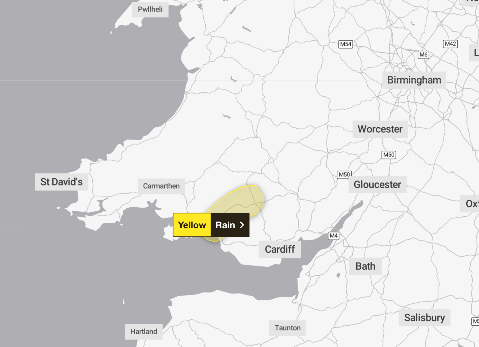
The regions affected are Bridgend, Merthyr Tydfil, Neath Port Talbot, Powys, Rhondda Cynon Taf, and Swansea.
The national meteorological service has reminded people to check if their property is at risk of flooding, and prepare a food plan and an emergency kit if so.
It said: “People cope better with power cuts when they have prepared for them in advance. It’s easy to do; consider gathering torches and batteries, a mobile phone power pack and other essential items.
“Be prepared for weather warnings to change quickly: when a weather warning is issued, the Met Office recommends staying up to date with the weather forecast in your area.”
It also remind people to check driving conditions to avoid potential road and traffic delays.

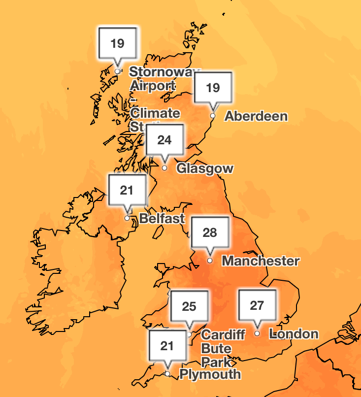
The hurricane marks the end of a dry spell for much of the UK after record-breaking temperatures have put the nation on track for the hottest summer on record.
Monday’s Bank Holiday saw temperatures reach 29.1C in the village of Hawarden in Flintshire and 24.5C in Magilligan, Londonderry, the Met Office said.
The previous record for Wales was 26.5C dating back to 1991, and 23.8C for Northern Ireland.
This is a breaking story, more to follow…

