


Large swathes of the country are expected to be hit by thunderstorms over the weekend as weather warnings come into place.
People in almost all of England, Scotland and Wales have been told to prepare for heavy downpours over the coming days.
The Met Office has warned parts of the country would be battered by torrential rain on Saturday which could cause “significant” flooding and a danger to life.
The forecasters have put out two new yellow weather warnings for Saturday, bringing to total number covering the UK to four in one day.
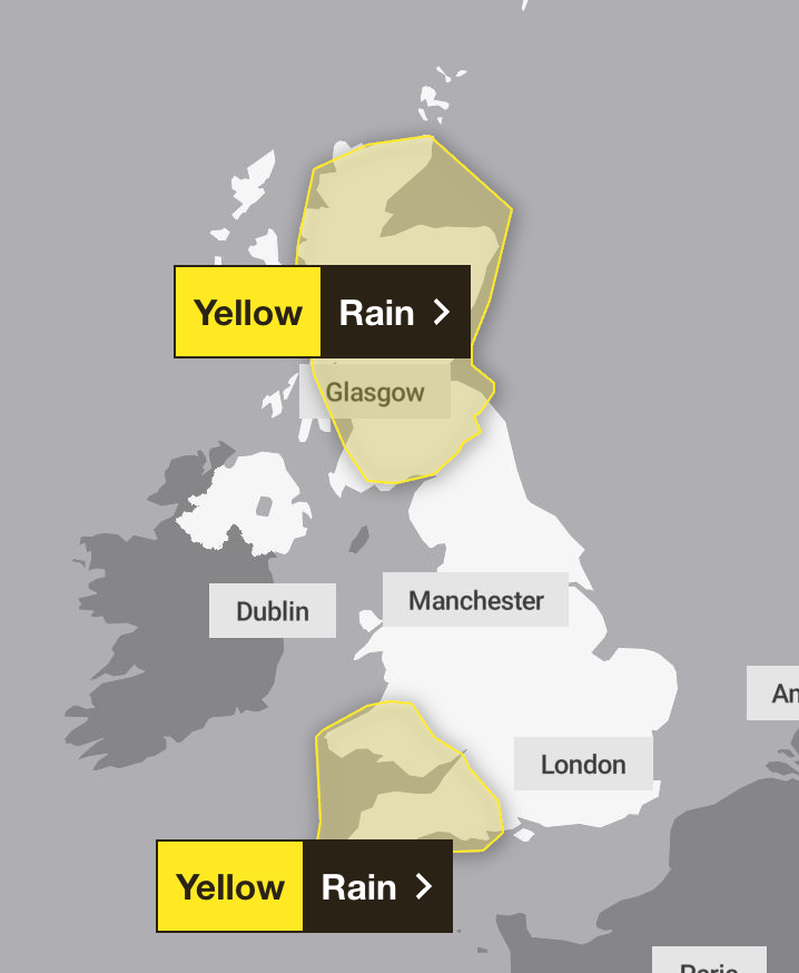
One new rain warning covers Wales and the South West of England and comes into place from 6pm today until 9pm on Sunday.
It also issued a thunderstorm warning for some of Northern Ireland from midday until 6pm on Saturday.
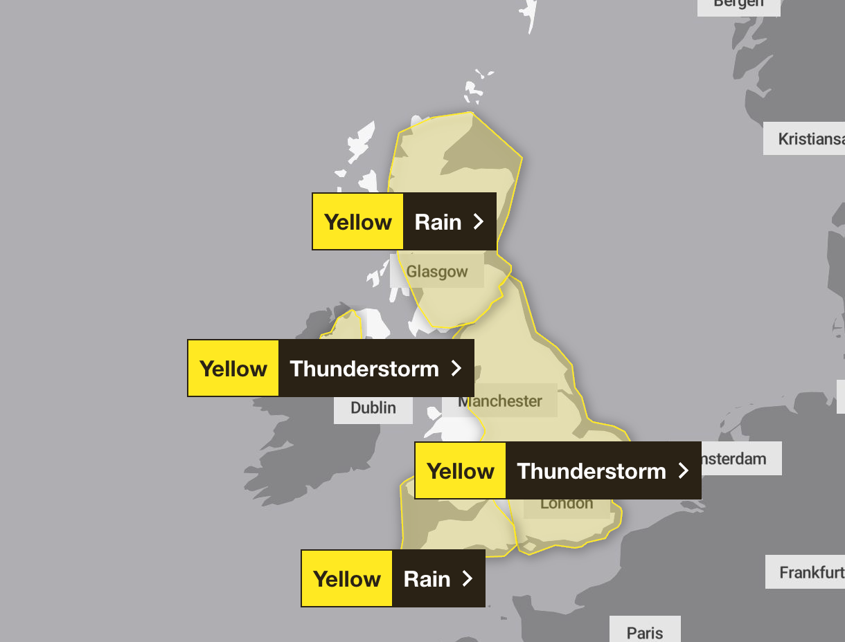
Two other yellow warnings are also in place on Saturday. Most of England will be covered by a yellow warning from midnight to 9pm. Eastern Scotland is also facing a yellow warning from 4pm until midday on Sunday.
The alerts mean most of the country will be under a weather warning at some point over the weekend.
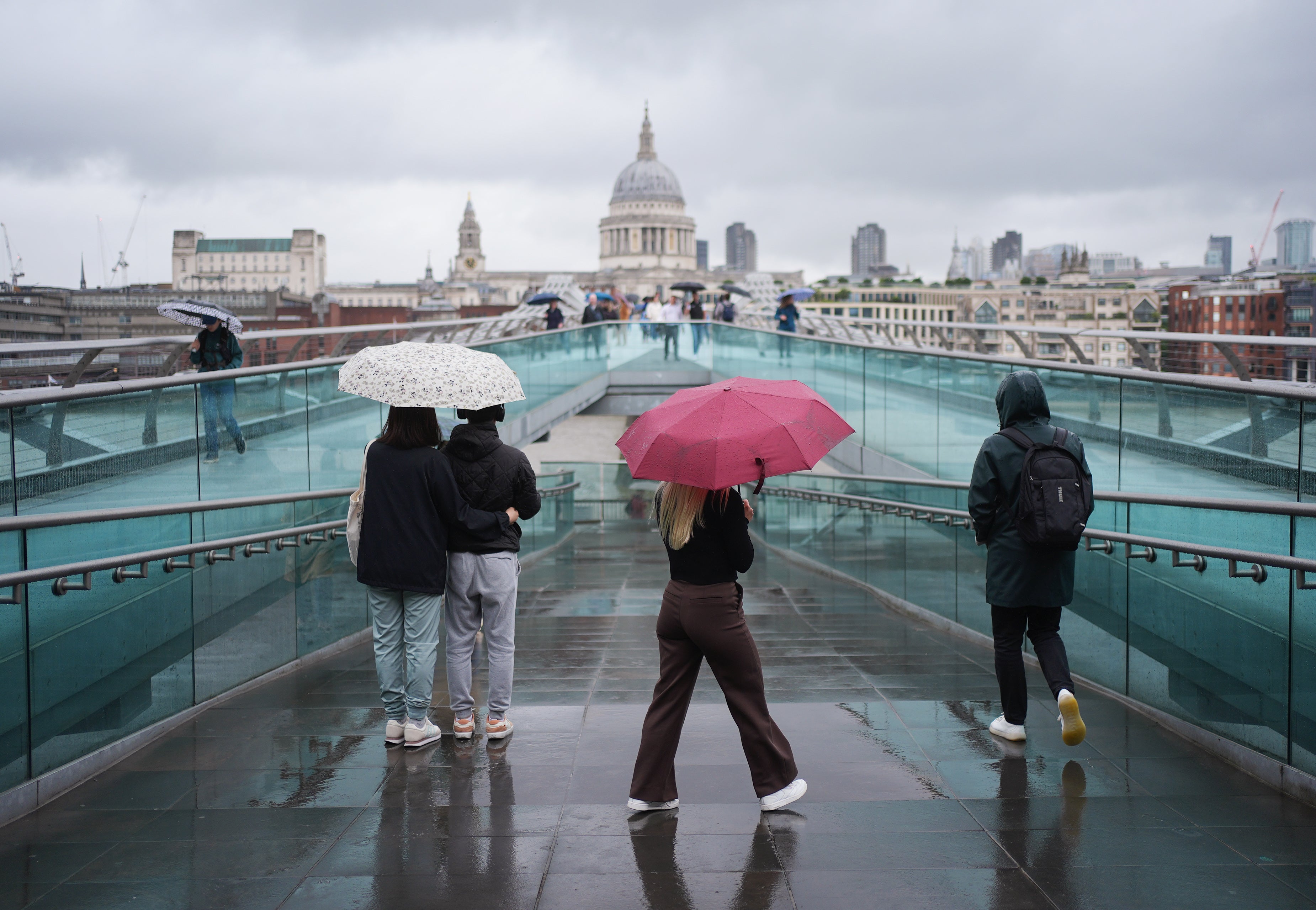
Earlier on Saturday, an amber alert came into force for London, parts of the south and south east of England from 4am to 11am. Downpours were seen across the capital in what was the first amber warning issued for London since January 2 2024.
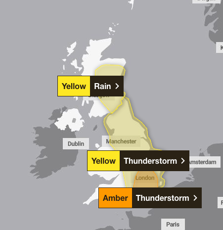
Forecasters have warned of sudden flooding in roads and homes with some more remote communities at risk of being cut off, while delays to train and bus services are also likely.
The warning area includes London, which is particularly susceptible to surface water issues during thunderstorms due to the high proportion of impermeable surfaces.
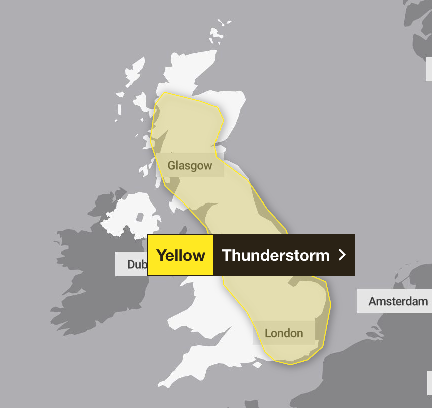
On Monday, a further warning for thunderstorms will come into place across much of England and Scotland. The yellow alert will begin at 11am and remain until 9pm.
Met Office Chief Meteorologist, Andy Page, said: “Intense rainfall will impact parts of the UK as thunderstorms move in from France. A range of severe weather warnings have been issued, including an Amber warning covering southeast England and London. The intense rainfall could lead to surface water flooding as well as frequent lightning and hail too.
“The situation is evolving, and warnings may be changed or added. This weekend is expected to be busy on the roads as more schools in England and Wales break up for the summer holidays, so it’s important people keep up-to-date with the very latest forecast. There will be spells of more pleasant weather in parts of the UK through the weekend, with some sunny spells in between systems as they move through.”

Met Office forecasters warn that spray and flooding could lead to difficulties for drivers, possible road closures, and the risk that some communities may become cut off as a result.
Damage to homes and businesses is also possible from adverse weather conditions.
Next week is expected to continue to have unsettled weather, with a mixture of showers and thunderstorms and sunshine.
Temperatures will be warm depending on the sunshine and conditions may settle by mid-week with showers still in the east.
It comes as Southern Water has become the latest company to bring in a hosepipe ban, to protect rare chalk stream habitat, as England battles exceptionally dry weather.
The company said restrictions on hosepipes for activities such as watering gardens, filling paddling pools or washing cars would come in for households in Hampshire and the Isle of Wight from Monday.
It is the latest announcement by water companies bringing in hosepipe bans in response to the driest start to the year since 1976 for England.
Rainfall across England was 20 per cent less than the long-term average for June, which was also the hottest on record for the country, with two heatwaves driving unusually high demand for water, the Environment Agency has said.
Drought was declared in East and West Midlands on Tuesday, with the region joining swathes of northern England in being impacted by the lack of rainfall.

