


Hurricane Erin has been downgraded to a Category 3 storm, yet its outer bands continue to batter the Virgin Islands and Puerto Rico with torrential rain and tropical-storm force winds.
Despite a reduction in maximum wind speeds, the hurricane’s overall size has grown, leading to tropical storm warnings for the Turks and Caicos Islands and a watch for the southeast Bahamas.
Although Erin is not expected to make a direct impact on the US East Coast, its expanded footprint could generate hazardous rip currents along the entire coastline. The National Weather Service has cautioned that gusty winds and flooding tides may wash out sections of the highway linking North Carolina’s Outer Banks by mid-week.
Bermuda could experience similar conditions as forecasters predict Erin will turn northwards, then northeast.
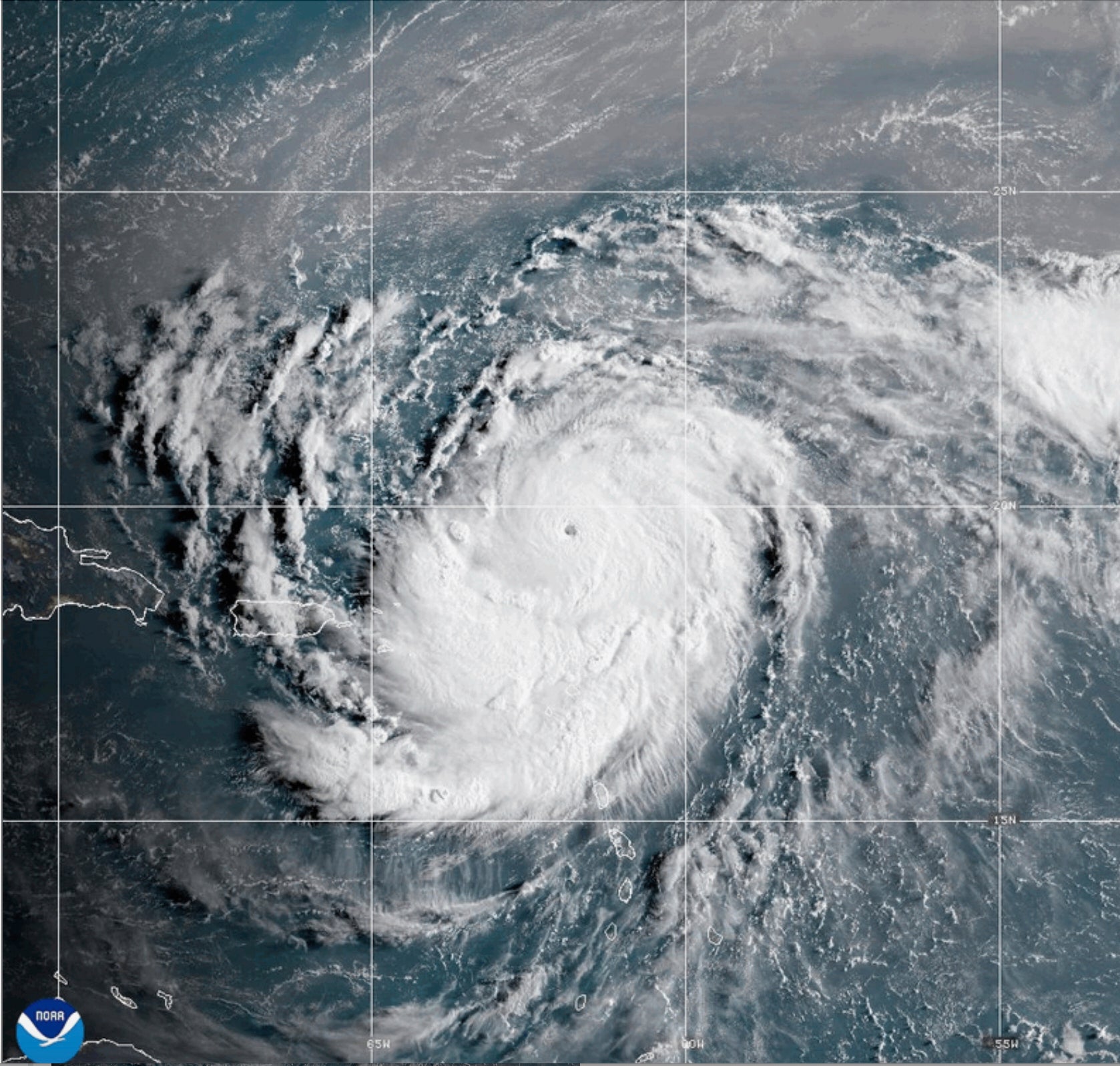
Erin, the first Atlantic hurricane of 2025, reached Category 5 status Saturday with maximum winds of 160 mph (260 kph) before weakening.
The storm’s maximum sustained winds were 125 mph (205 kph) late Sunday morning, according to the National Hurricane Center in Miami.
The winds decreased as the storm went through internal changes. Erin is expected to remain powerful for the next several days, forecasters said.
“You’re dealing with a major hurricane. The intensity is fluctuating. It’s a dangerous hurricane in any event,” said Richard Pasch of the National Hurricane Center.
Erin’s center was about 235 miles (380 kilometers) north-northwest of San Juan, Puerto Rico, and 200 miles (320 kilometers) east of the Grand Turk Island, moving west-northwest at 13 mph (20 kph).
The rain and winds from the outer bands of the storm left about 147,000 customers without power Sunday morning in Puerto Rico, according to Luma Energy, a private company that oversees the transmission and distribution of power on the island. The weather canceled more than 20 flights, officials said.
Swells were also expected to affect portions of the Virgin Islands, Puerto Rico, Hispaniola and the Turks and Caicos Islands during the next couple of days, forecasters said.
The Coast Guard allowed all ports in Puerto Rico and the U.S. Virgin Islands to reopen Sunday as winds and rains decrease.
A tropical storm warning means tropical storm conditions are expected somewhere within the warning area, and in this case, within 24 hours, the hurricane center said. Heavy rain is still expected across the Virgin Islands and Puerto Rico, with rainfall of 3 to 6 inches (about 7.6 to 15 centimeters), with 8 inches (20 centimeters) in some isolated areas.
The government of the Bahamas also issued a tropical storm watch for the Southeast Bahamas.
Scientists have linked the rapid intensification of hurricanes in the Atlantic to climate change. Global warming is causing the atmosphere to hold more water vapor and is spiking ocean temperatures, and warmer waters give hurricanes fuel to unleash more rain and strengthen more quickly.

