

The UK is set to bask in a mini heatwave this week as temperatures could reach up to 28C in “an early dose of summer”, the Met Office has said.
The mercury could hit 10C above average by the middle of this week as Britain enjoys “a very fine spell of weather”, according to the Met Office’s deputy chief meteorologist David Oliver.
This is despite being likely to fall just outside of official Met Office heatwave thresholds, said Mr Oliver. To officially qualify as a heatwave, temperatures must hit a certain temperature – of 25C across much of Britain, rising to 28C in London – for three consecutive days.
But while no overall heat records are expected to be broken – with the UK record for April standing at 29.4C, and May at 32.8C – some local areas could see new monthly highs.
Met Office meteorologist Craig Snell said: “We’re certainly on track to see the warmest spell of the year so far.”
Monday is likely to be the hottest day so far of 2025, with the following days potentially setting several new highs until the weather peaks, said Mr Snell.
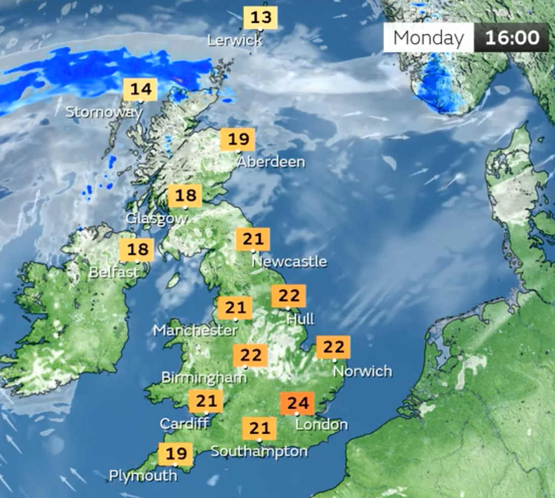
After temperatures reached a provisional high of 22.4C at Hull’s East Park on Sunday, parts of the country are expected to see highs of 25C on Monday.
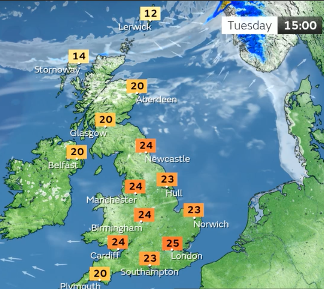
The warmer climes are set to be widely enjoyed across the UK, with both Belfast and Glasgow set to see highs of 18C on Monday and 20C on Tuesday, similar to conditions expected further north in Aberdeen.
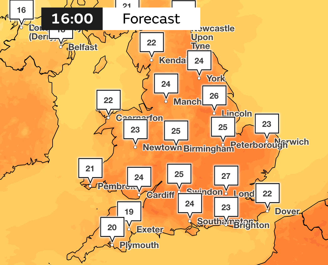
Broadly, however, the hottest weather is expected in London and South East England this week.
The mercury will rise each day until a peak on Wednesday or Thursday of 28C, with a small chance of seeing 29C, according to the Met Office.
Mr Snell added: “There will be plenty of sunshine around, the very north of Scotland at times will see some spells of rain, especially at the beginning of the week, but it’s going to be limited to the far north of Scotland. For a lot of the UK it’s going to be largely sunny.”
On Friday, temperatures will start to drop towards the average for the time of year, with temperatures in the high teens in the south and mid teens in the north, Mr Snell said.
There is the low risk of some heavy showers or thunderstorms developing later on Thursday and into Friday, but most areas should remain largely dry, the Met Office said.
Cooler temperatures are expected over the weekend, with the weather likely becoming more changeable next week as dry, settled periods are interspersed with spells of wetter weather and temperatures closer to the monthly average for May.
Additional reporting by PA
