


The Met Office has issued multiple weather warnings over the weekend as Storm Ingrid descends upon the UK with heavy rain and lashing winds.
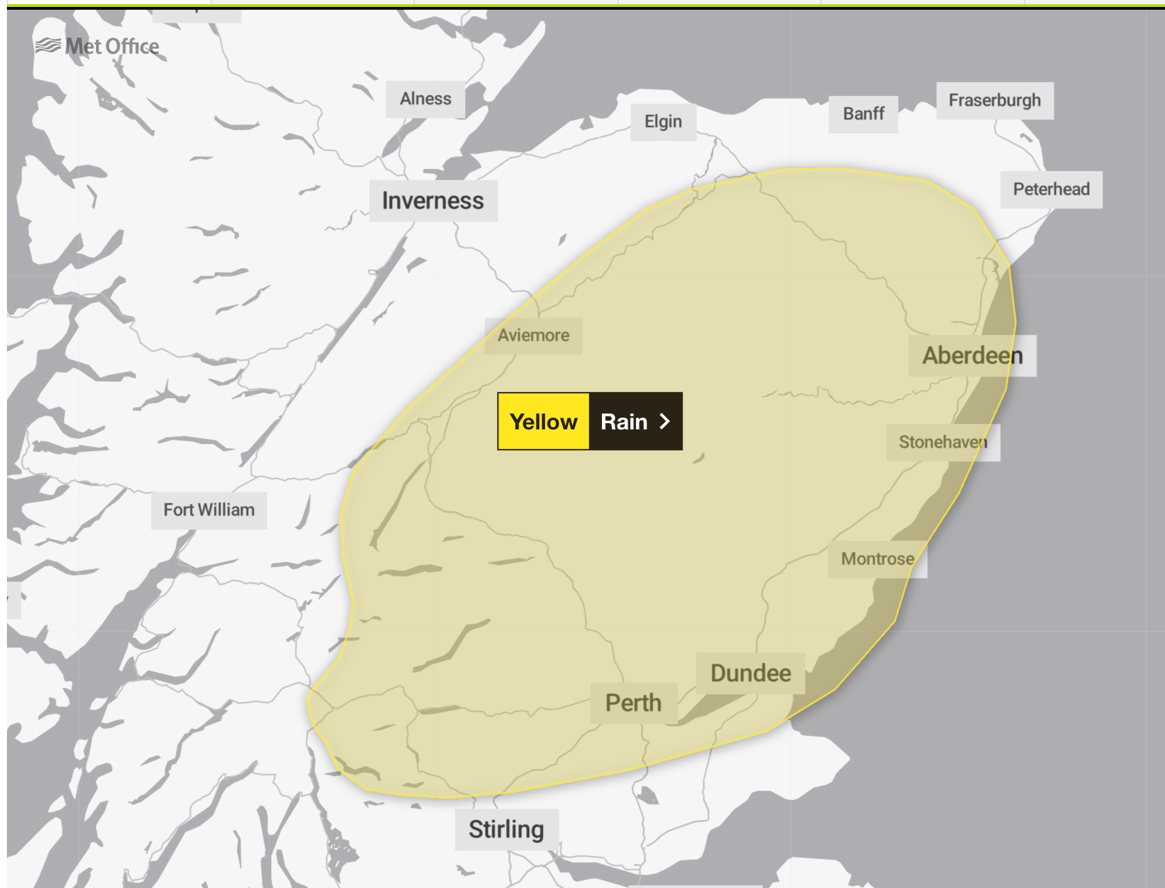
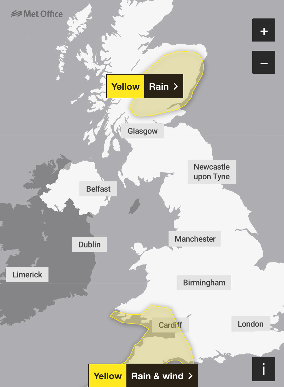
Yellow weather warnings for rain and wind were issued earlier this week and remain until Saturday night for parts of southwest England and Wales, while a weather warning for rain is in place until Sunday morning for parts of Scotland.
The Met Office warning covers Angus, Dundee, northern Fife, Aberdeen, Aberdeenshire, parts of the Highlands, Moray, Perth and Kinross, and Stirling on Friday.
It warns of a “small chance of fast-flowing or deep floodwater causing danger to life”. Storm Ingrid was named by the Portuguese national weather service IPMA.
Perth and Kinross Council said many roads in the region were closed due to flooding as of 6am on Friday, including the A94 between A93 Meikleour crossroads and A923 Bendochy crossroads, and the Queen’s Bridge in Perth.
On the railways, ScotRail said speed restrictions will be in place on the Inverness to Edinburgh/Glasgow/Aberdeen, Glasgow to Dumfries, Stranraer to Ayr/Kilmarnock and Glasgow to Mallaig/Oban lines.
Forecasters said: “Rainfall accumulations of 30 to 60mm are likely fairly widely inland, with as much as 80 to 120mm possible over the highest ground exposed to the brisk southeasterly winds.
“Given the nature of the ground following recent rain and snow thaw, this may lead to some flooding in places.
“Rainfall totals will be smaller in coastal areas but strong onshore winds and large waves at times will be additional hazards.”
Forecasters predict that rain will affect parts of eastern Scotland already affected by recent heavy rainfall, leading to further flooding and disruption to travel.
Many areas are likely to see a further 20 to 30mm of rain, and a few places could see 50mm, while above 400 to 500m, a lot of this will fall as snow, forecasters said.
The Scottish Environment Protection Agency has issued 22 flood warnings and four flood alerts. Three people in Aberdeenshire had to be rescued from their stranded vehicles by firefighters.
Two people were rescued from a minibus on the B977 near Kintore at around 8.30am on Thursday, while another person was brought to safety from a car in a separate incident at around the same time near Banchory.
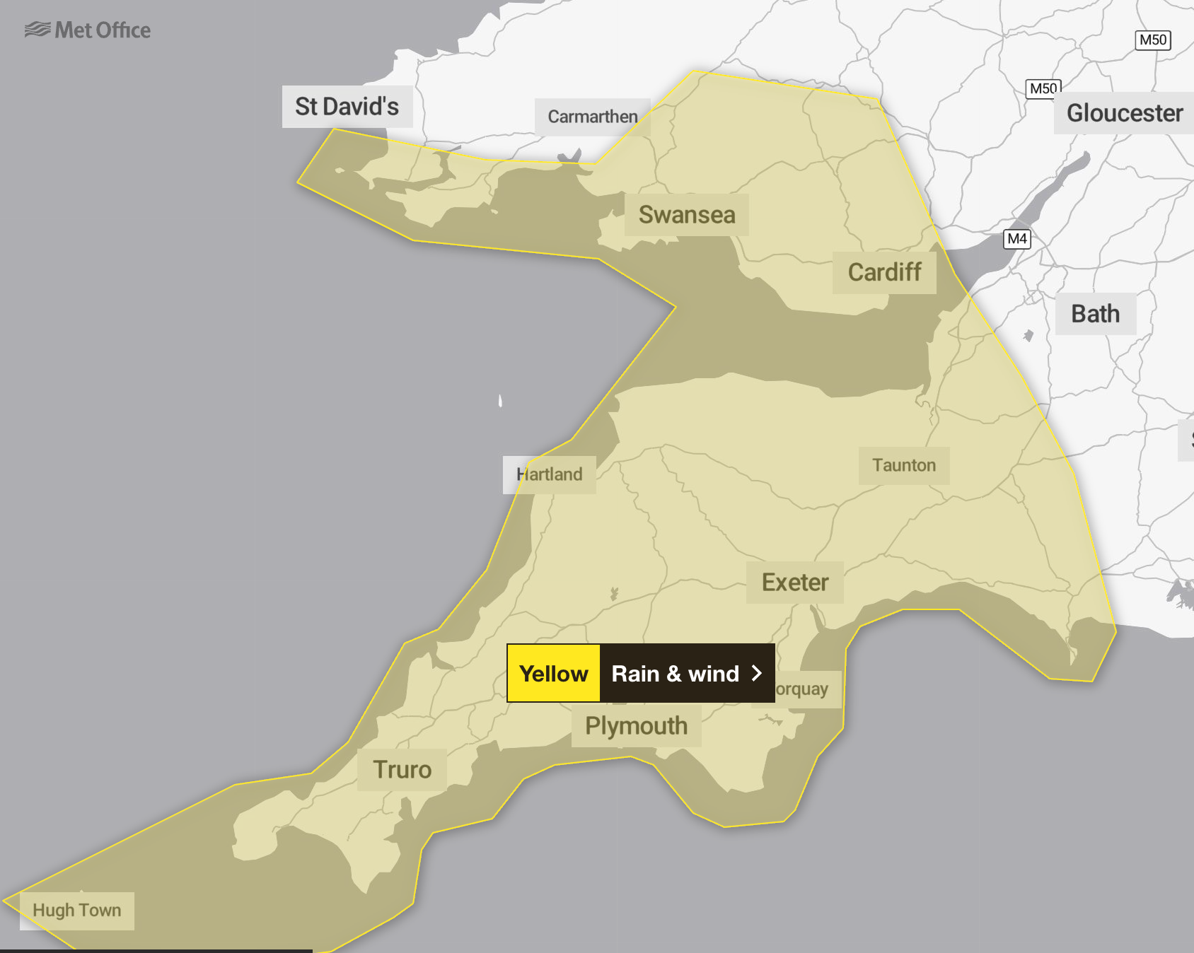
In southwest England and Wales, gusts of 45 to 50mph are expected widely inland and could reach up to 60mph near coasts, with winds peaking during Friday evening before gradually easing overnight and into Saturday morning.
The areas affected are:
- Cornwall
- Devon
- Dorset
- Isles of Scilly
- North Somerset
- Plymouth
- Somerset
- Torbay
- Blaenau Gwent
- Bridgend
- Caerphilly
- Cardiff
- Carmarthenshire
- Merthyr Tydfil
- Monmouthshire
- Neath Port Talbot
- Newport
- Pembrokeshire
- Powys
- Rhondda Cynon Taf
- Swansea
- Torfaen
- Vale of Glamorgan
The Met Office warned those living on the coast to stay safe during stormy weather by being aware of large waves.
“Even from the shore, large breaking waves can sweep you off your feet and out to sea,” the forecaster said. “Take care if walking near cliffs; know your route and keep dogs on a lead. In an emergency, call 999 and ask for the coastguard.”


