

Two storms are intensifying in the western Atlantic – and one poses a threat to U.S. residents.
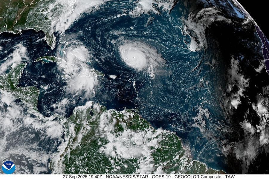
Hurricane Humberto rapidly intensified from a Category 1 to a Category 4 hurricane on Friday, but it is expected to be steered safely in the Atlantic Ocean and away from the U.S. by surrounding high and low-pressure systems. Meanwhile, the other developing storm appears to be heading toward the Southeast coast, raising concerns about possible impacts in the region.
That system, now designated as Tropical Depression Nine, is forming near Hurricane Humberto and is expected to develop into Tropical Storm Imelda in the coming days.
If Imelda makes landfall in the U.S. it would be the first storm to hit the contiguous U.S. during the typical hurricane season.
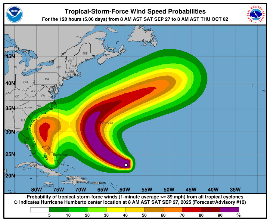
Forecasters warn that Hurricane Humberto could generate life-threatening surf and rip currents this weekend for the northern Leeward Islands, the Virgin Islands, Puerto Rico and Bermuda.
Meteorologists are closely monitoring the interaction between these two storms, as their proximity means their energy could influence each other’s paths and strength. This interaction, known as the Fujiwhara effect, complicates forecasting efforts.
Despite the uncertainty, experts warn that the system expected to become Imelda has already brought significant rainfall to Caribbean islands and could pose a “substantial risk” of heavy rain and strong winds to the Southeastern United States in the coming days.
Currently, tropical storm warnings and watches are in effect across much of the Bahamas, where Tropical Depression Nine is passing through this weekend.
The National Weather Service has forecast up to eight inches of rain in the Bahamas, with some areas in Cuba potentially receiving a foot or more by Monday.
On Saturday morning, a tropical storm watch was issued for Florida’s eastern coast, stretching from the Palm Beach and Martin Counties line in the south to the Flagler and Volusia Counties line in Central Florida.
Additional watches for tropical storm-force winds were issued along the southeastern U.S. coast, from Georgia to Florida, including coastal waters near Altamaha Sound in Georgia, Flagler Beach and Jupiter Inlet in Florida, as well as multiple coastal communities such as Titusville, Melbourne, Vero Beach, and parts of Volusia and Martin Counties.
Forecasters also cautioned residents of the Southeastern United States to prepare for a “significant risk” of wind, rain, and storm surge next week, regardless of whether the system officially becomes Tropical Storm Imelda.
Meanwhile, Hurricane Humberto is expected to continue intensifying over the coming days, adding another layer of concern for the region.
The Atlantic hurricane season started slowly this year, but forecasters at the National Oceanic and Atmospheric Administration predict an above-average season overall. Forecasters expect up to 18 named storms by the time the season ends in November, compared to a typical season’s 14 storms.
If Tropical Depression Nine becomes Imelda, it would mark the ninth named storm of the 2025 season.

