


The Met Office has issued a yellow weather warning for rain covering the South and Wales on Wednesday.
Heavy rain is expected to cause travel disruption and flooding, with thunderstorms forecast in some areas. Forecasters say we could see as much as 60mm of rainfall between the early hours of Wednesday morning and the afternoon, with the weather warning in place until 2pm.
They have also warned coastal gales are “likely” along English Channel coasts, saying people should prepare for “heavy rain and strong winds” and potential power cuts in some places.
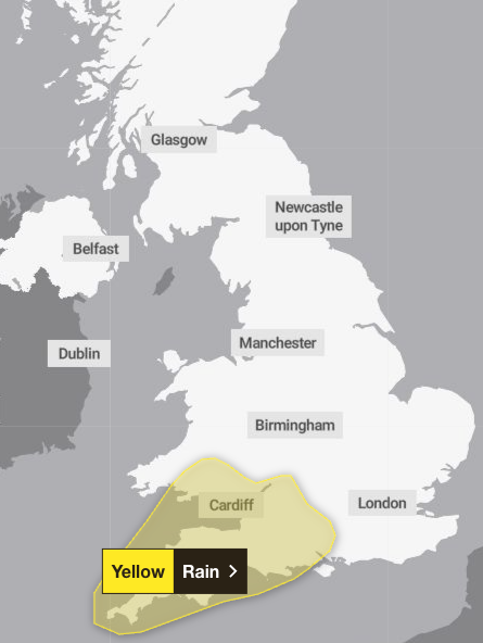
The warning covers Hampshire, Southampton, West Berkshire, and much of the South West and South Wales.
“Heavy rain and strong winds will move northeast through the first part of Wednesday, followed by heavy showers and some thunderstorms, these becoming more isolated through the afternoon,” the warning from the Met Office says.
“Rainfall totals widely 20-30 mm, but some places could see 40-60 mm within a period of 6-9 hours.Coastal gales are likely for a time, especially along English Channel coasts.”
People have been urged to plan journeys ahead, with those in areas at risk of flooding advised to prepare a flood plan and an emergency flood kit.
It comes after the Met Office confirmed summer 2025 to be the hottest on record in the UK. The country saw back-to-back heatwaves with the mean temperature from 1 June to 31 August sitting at 16.10C – 1.51C above the long-term average.
This is a breaking story, more to follow…

