


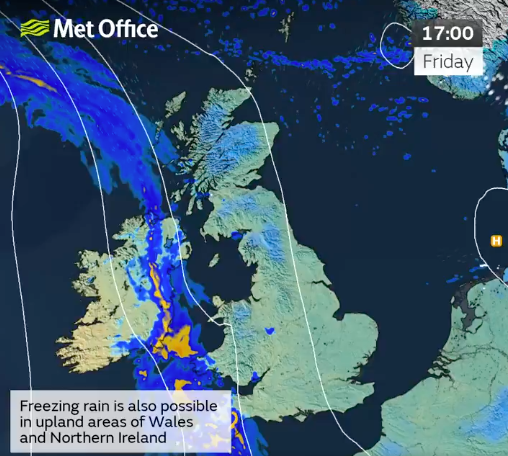
Britain is braced for freezing rain this week – a rare phenomenon which can bring down trees and ground planes, the Met Office warned.
The rare weather event – commonly known as ice storms in North America – is not often seen in the UK because the conditions needed for it are quite specific.
It is rainfall that has become “supercooled” as it falls from the sky, travelling through various temperatures in the atmosphere.
It starts as sleet or hail high up in the atmosphere, but as it travels down it melts through a layer of warmer air, then refreezes again through a layer of colder air near the surface.
These conditions could be seen in Britain over the coming days, as high pressure to the north and east of the country continues to bring cloud and cold air.
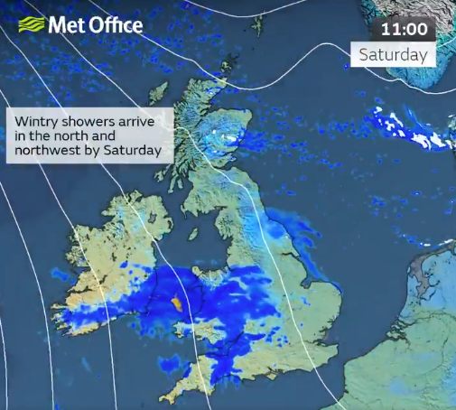
Met Office forecaster Honor Criswick said: “There is a chance we could see some hill snow as this area of rain moves into colder air.
“There is even a chance we could see some freezing rain, so do take care as there could be some icy stretches by the morning.
“But for many, most towns and cities will just about drop below freezing, so colder nights are likely compared to recent nights.”
She said that tonight would see a “chillier night on offer compared to recent nights – likely to see some frost, possibly even some ice too, some outbreaks of rain starting to push into Cornwall, parts of Northern Ireland, perhaps the far South West of Wales later”.
Ms Criswick continued: “Still continuing to see that risk of freezing rain too, so still a chance of some icy stretches.
“But away from this cloud, an area of rain – that cloud breaking up a bit more so perhaps seeing a bit more sunshine by the time we reach tomorrow afternoon.
“But temperatures remaining fairly similar if not a touch below in some places. So despite a chance of seeing a little bit more sunshine on the cards tomorrow, it is still going to be feeling chilly so we’ll need to wrap up warm to enjoy it.”
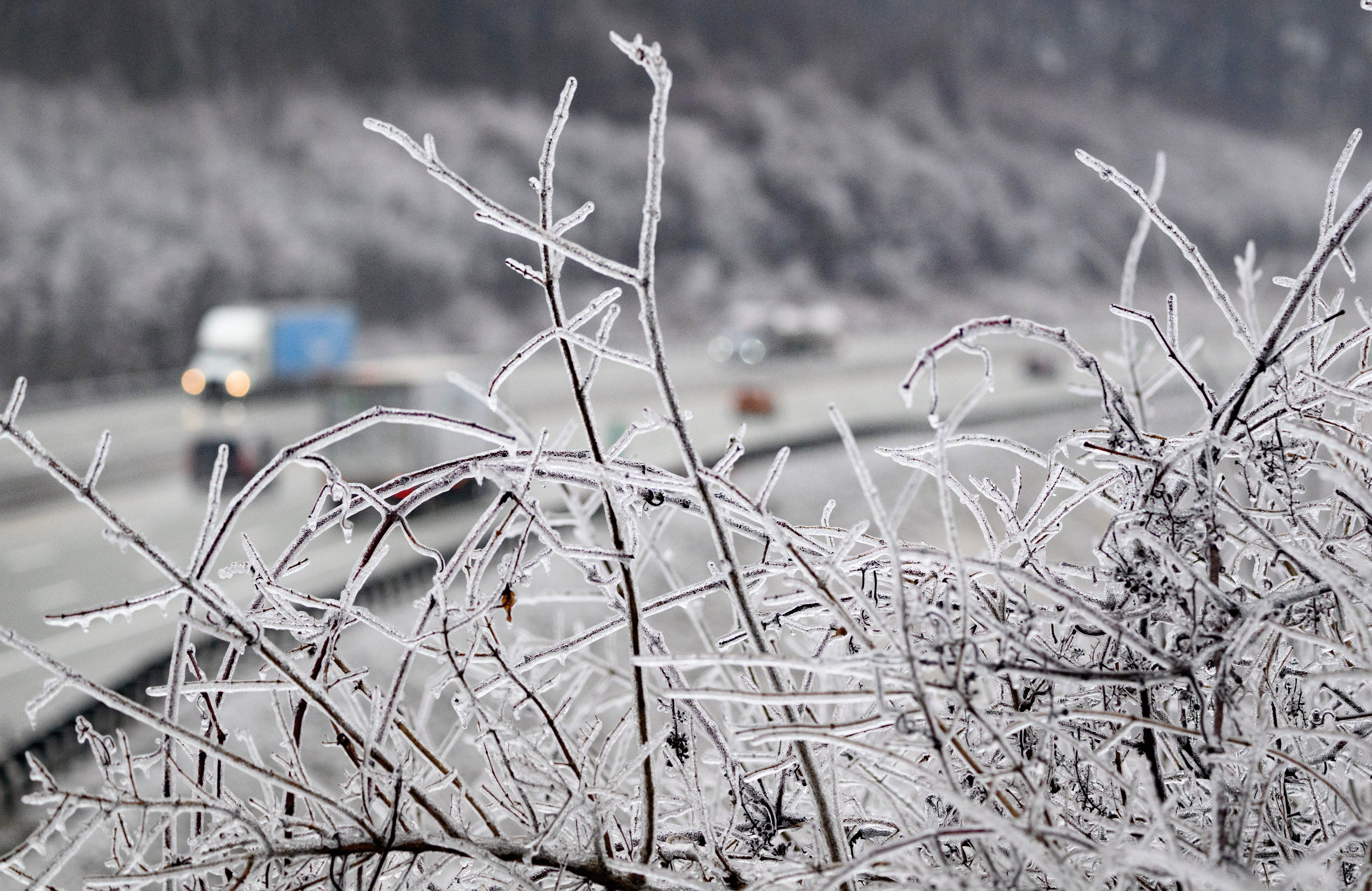
Freezing rain can produce striking effects, as the rain drop spreads out momentarily across the surface before it freezes, encasing the surface in a layer of clear ice.
The weight of the ice can sometimes be heavy enough to bring down trees and power lines, and the glaze of ice on the ground effectively turns roads and pathways into an ice rink, according to the Met Office.
It can also prove extremely hazardous for aircraft, with the chance of icicles forming across the wings of an airplane.
The ice is very clear, often referred to as black ice, because it is so difficult to see, making it treacherous for pedestrians and drivers.


