


Iran’s control of the Strait of Hormuz has created chaos in the global economy and has become the most urgent problem facing Donald Trump and Israel as they prosecute their war against Tehran.
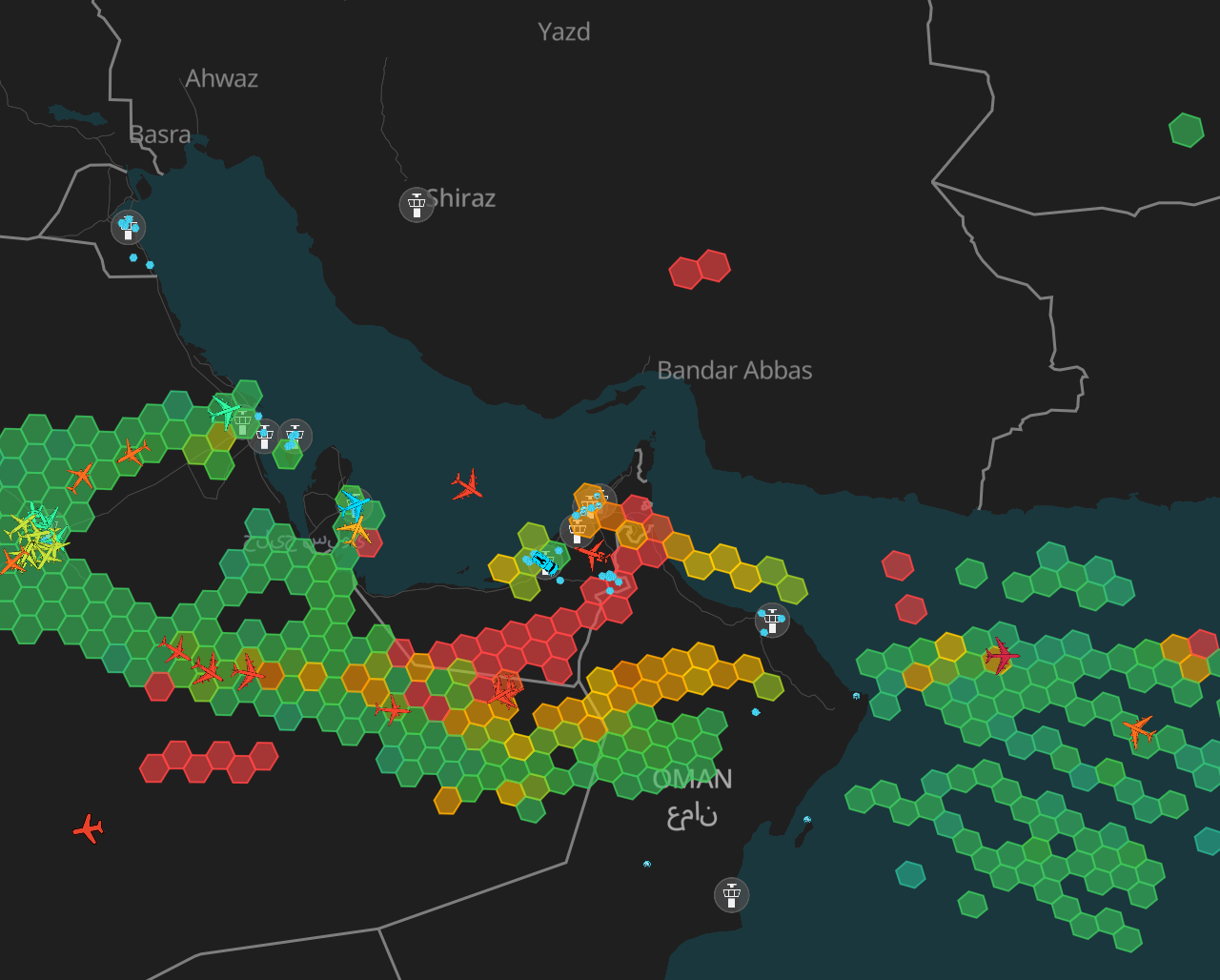
Iranian attacks in the vital channel have reduced commercial traffic by as much as 95 per cent in just three weeks, forcing energy prices up and piling on the pressure to find a resolution.
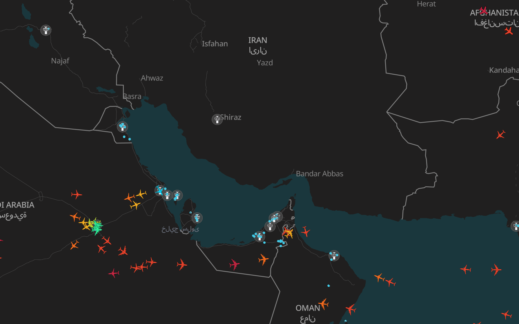
But, underlying the dramatic clashes across the region, forces are quietly fighting an invisible war by land, air and sea, distorting tracking information to sow chaos or hide in plain sight.
GPS interference across the Middle East has spiked since the US and Israel struck Iran on 28 February, plunging both sides into an “electronic warfare arms race” to contain the impact and get an advantage, analysts told The Independent.
While the targets are primarily military, disruption is also hurting commercial shipping off the UAE, Qatar, Oman and Iran, fortifying Tehran’s chokehold on the Strait and adding another dimension to the spiralling conflict.
How does GPS manipulation work?
Jamming and spoofing are among the most common forms of interference, and can affect anything using a satellite to determine its location, from a mobile phone to an aircraft carrier.
GPS works by calculating how long it takes signals from a satellite to reach a receiver on the ground. Because those signals are quite weak by the time they reach Earth, they are fairly easy to disrupt.
An attacker can jam a signal by overwhelming the real messages from global navigation satellite systems (GNSS) with electromagnetic noise, affecting how they reach the receiver. On a phone, you might see your map freezing or jumping around.
Spoofing is a more sophisticated manipulation of signals. It works by transmitting fake satellite signals designed to mimic the real ones. The receiver then accepts these signals and provides a false location.
This can have devastating effects for civilian and military operators. Last May, the container ship MSC Antonia began showing positions far from its true location while transiting the Red Sea.
On board, the crew would have seen that they had moved hundreds of miles south. The crew became disoriented, and the ship eventually ran aground.
The grounding caused millions of dollars in damage and required a salvage operation that lasted over five weeks.
How do militaries use jamming and spoofing?
Philip Ingram, a former British Army colonel and intelligence expert, told The Independent that jamming has been an essential feature of modern warfare since the Second World War.
“It’s an integral part of your planning. You plan it the same way as you plan the ammunition you’re going to put in your rifle,” he said.
Iran – “prolific” in spoofing – will be using interference in the Gulf to “add confusion and disrupt any of the allied intelligence gathering”, he said.
Other kinds of jamming can stop aircraft communicating and cut electronic signals to projectiles flying in their direction.
Alex Lungu, co-founder of Stockholm-based aviation intelligence company Wingbits, said that GPS interference is “an efficient tool for confusing your adversaries and then also protecting yourself”.
Mr Lungu told The Independent that all parties involved in the conflict could stand to gain from using the technology.
“They all have an interest in taking the ability to navigate from the other,” he said.
Mr Ingram agreed, saying Saudi Arabia, the UAE and Qatar would all be using spoofing for defensive purposes, too.
“What they’re trying to do is confuse the Shahed drones that are coming in. That’s really what they’ll be focused on,” he said.
“But the reality is, as we’ve seen, [with] the Shahed 136 drone that hit the UK Sovereign base area in Cyprus, the guidance mechanism that’s in there has come from Russia and the guidance mechanism has got anti-jamming capability built into it.
“So it’s sophisticated technology that’s been passed from Russia back to Iran for Iran to incorporate into their Shahed drone,” he said, framing it as a “big electronic warfare arms race”.
Intelligence experts believe Iran has strengthened its offensive capabilities since the 12 Day War last June, which also saw widespread jamming and spoofing across the region.
Former French foreign intelligence director Alain Juillet told France’s Tocsin podcast that the regime in Tehran has likely procured China’s BeiDou satellite navigation system, as its targeting has become much more accurate since last summer.
Military analyst Patricia Marins told bne Intellinews that the sophisticated Chinese tech is “essentially unjammable”, using a “complex frequency hopping and navigation message authentication (NMA), which prevents spoofing”.
How are commercial flights and ships being affected?
Most countries in the Middle East have closed their airspace since war erupted. Commercial airlines have cited safety risks in their decision to postpone flights, costing the travel industry around £450m per day.
In the first days of the war, the UK government organised flights back from Oman for Britons stuck in the region. Some flights are still flying from Muscat.
Mr Lungu said that all flights flying through Omani airspace could have been affected by the growing pattern of “indiscriminate” interference.
“GPS jamming is inherently difficult to contain within precise geographic boundaries, while the range and directionality can be influenced by the source, spillover into neighbouring airspace and countries is common.”
Charlie Brown, senior advisor to United Against Nuclear Iran (UANI) and a former US Navy officer, said the enhanced risks to ships caused by interference would figure into risk assessments for the owners of commercial ships, operators and insurers.
“The result to shipping, which depends on [GPS] for routine operations, causes extra confusion and hampers safe navigation. It’s not impossible for shipping to navigate without GPS… The men and women on the ship can still navigate. It’s just harder and they need to be more aware of what they’re doing,” he told The Independent.
Mr Brown explained that there have been efforts in recent years to ensure that mariners are not overly reliant on their GPS navigation systems and are still using multiple sources and cross-checking data for when automatic systems fail.
“It is serious. It adds complexity. It adds risk. And it adds inconvenience both to the people on the ships, but also the people ashore trying to understand what’s going on at sea.”
“Both sides are doing for offensive reasons, and both sides are doing it for defensive reasons,” he added.
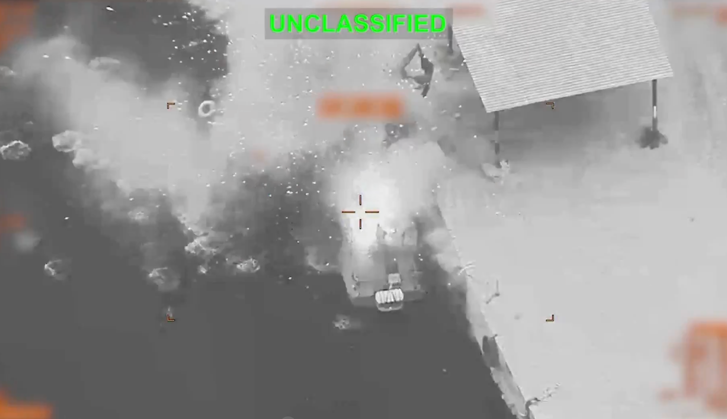
At the time of writing, at least 22 civilian ships – tankers, container ships and other bulk carriers – have been attacked, according to data from the Institute for the Study of War and AEI Critical Threats Project.
The risk from drones and missiles is compounded by unreliable GPS data in narrow channels like the Strait of Hormuz, where even small navigation errors can lead to groundings or collisions.
When will it end?
GPS interference has played a vital role in intelligence for decades. The war in Iran is just the latest conflict to force innovation as adversaries try to outmanoeuvre each other.
“Looking at the data from what happened in the conflict with Israel and Gaza, and what’s happening in Russia, my guess is that it will keep going on while the conflict is in progress,” assessed Mr Lungu.
Mr Ingram pointed to Ukraine as an example of how electronic warfare, through drones, has shaped and reshaped the conflict as new technologies cancel each other out.
“It hasn’t quite got to that level in the Middle East yet, but the arms race is on.”

