


A cold weather health alert covering large parts of the UK has been issued for later this week with sub-zero temperatures set to blast the country.
The UKHSA has issued a yellow alert between Friday and Monday, meaning the weather is likely to pose a greater risk to the life of vulnerable people and have minor impacts on health and social care services.
Temperatures could drop as low as -4C in some areas on Friday evening into Saturday morning, with freezing weather forecast in major cities including: Manchester, Birmingham, Newcastle, Edinburgh, Glasgow, Aberdeen and Derry, according to the Met Office.
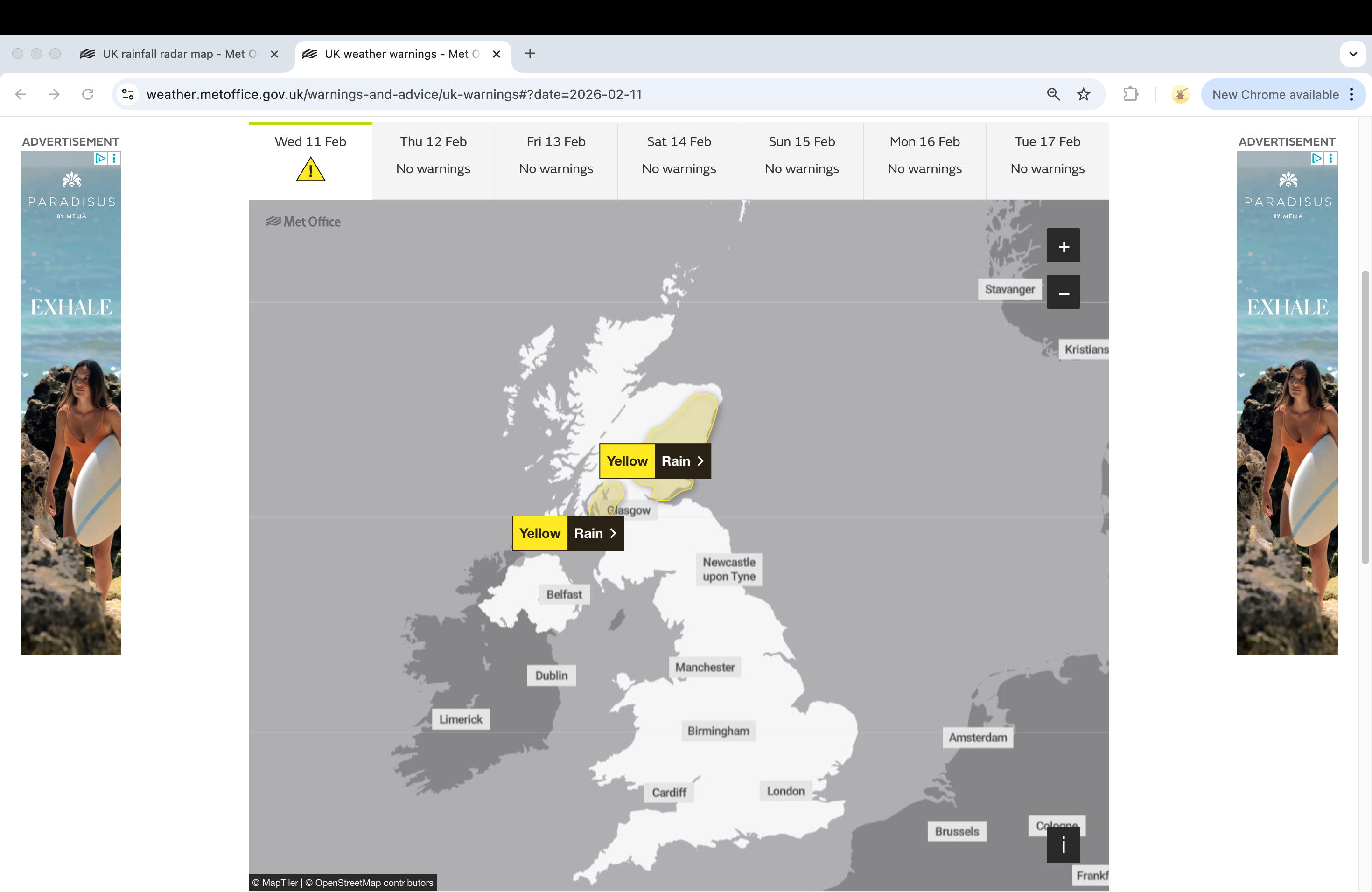
A yellow weather warning of rain across western Scotland and in the east from Aberdeenshire down to Fife is in force until midnight on Wednesday. This will persist across eastern Scotland during the day and may lead to some travel disruptions and possible flooding after recent rainfall.
Two fresh weather warnings of snow and ice have been issued for Thursday and Friday across Scotland. The impacted regions include: Central, Tayside and Fife, Grampian, Highlands and Eilean Siar, Orkney and Shetland, as well as south west Scotland, Lothian Borders and Strathclyde.

Grahame Madge, a Met Office spokesman, said: “There is an Arctic Maritime airmass that will be moving south during this week, bringing a colder influence to the UK’s weather – we are already issuing snow and ice warnings for northern Britain. This colder spell is likely to be brief as longer-range indications are from later in the weekend that the weather will be more dominated by Atlantic conditions.”
The Met Office said, levels of snow will vary by area, but is possible on low ground by Friday morning, while on hills above 300 metres accumulations of up to 10 cm are possible. In addition to the snow, temperatures will fall quickly, and this is likely to lead to ice on untreated surfaces.”

As of Wednesday morning, there are 87 flood warnings and 151 flood alerts in place for England issued by the Environment Agency. The Scottish Environment Protection Agency has also issued three flood warnings and seven flood alerts.
Ongoing flooding from groundwater is likely to affect Dorset, Wiltshire, Hampshire and West Sussex over the next four days, according to the Environment Agency. River flooding is also expected along the River Trent and rivers across Somerset and Wiltshire on Wednesday.
.png)
Forecasters warn that rain is likely to be heavy at times, with 15-25 mm due to fall quite widely, with a potential for 30-40 mm building up over high ground.
.png)
As temperatures reach freezing levels, snow is predicted to fall above 300-400 metres, with 5-10cm expected to accumulate across Aberdeenshire, Angus and Perthshire by the end of Wednesday.
The warning in the east covers Angus, Dundee, Fife, Perth and Kinross, Stirling, Aberdeen and Aberdeenshire, while in the west it covers Argyll and Bute, Inverclyde, North Ayrshire, Renfrewshire and West Dunbartonshire.
So far this year, Cardinham in Cornwall has recorded some rain every single day of the year. Overall, Cornwall and County Down in Ireland both logged their wettest January on record, while Northern Ireland endured its wettest in 149 years.
Across the UK, 26 stations set new monthly rainfall records, while several daily records were broken – Plymouth saw its wettest January day in 104 years, Hurn in Dorset in 74 years, and Dunkeswell in Devon in 57 years.


