

When you step outside your door, the weather you experience is shaped by an ever-shifting, interconnected system of air and ocean currents that span the entire globe.
Now, scientists believe this year’s weather may be turned upside down by a super-strong version of one of our planet’s most notorious climate phenomena: El Niño.
“Whew. All signs are increasingly pointing to a significant, if not strong to very strong, El Niño event,” said climate scientist Daniel Swain on X (formerly Twitter) last week.
“Changes in location, intensity and frequency of droughts, floods, heat waves and hurricanes are all likely,” said Washington Post meteorologist Ben Noll.
It comes as forecasters at the National Weather Service warned of an unusually bad spring storm season across the U.S. South and Midwest, with more than six million Americans at risk from thunderstorms and potentially tornadoes.
In his X post, Noll estimated a 22 percent chance of a “super El Niño” by August and an 80 percent chance of a “strong” one based on new modeling from the European Center for Medium-Range Weather Forecasts.
This outcome is not set in stone, and predictions in early spring tend to be less reliable than predictions later in the year. Some scientists have warned against making assumptions just yet.
But if it does happen, the impact on U.S. weather would be profound.
What is El Niño?
For hundreds of years, fishermen off the western coast of South America had their livelihoods rocked by a periodic change in water temperature that caused mass death in the food chain they relied on.
Since it always happened around December, they dubbed it “El Niño de Navidad” — literally ‘the little boy of Christmas’ — in a sardonic reference to the birth of Jesus Christ.

What we now call simply El Niño (the boy) is a disruption in the usual pattern of water and air movement in the Pacific Ocean, occurring roughly every two to seven years.
Normally, warmer surface water from the eastern Pacific is continuously moved westward by strong winds. Colder water wells up from the deep ocean to fill the gap, making the eastern Pacific far cooler than the western Pacific.
Sometimes, though, this process falters (although scientists disagree on exactly why). Those stiff westerly winds get weaker, and the eastern Pacific gets warmer, causing massive updrafts of warm air that change the path of the air currents flowing east over the Americas.
According to The Washington Post, a ‘super’ version of El Niño happens roughly once every 10-15 years. The impact on our weather is profound — and can be catastrophic.
How would it affect the U.S.?
The impact of El Niño on the U.S. is often unpredictable, but there are some patterns.
A strong El Niño generally makes the whole world warmer, as all that heat wafting up from the ocean gets spread far beyond the tropics.
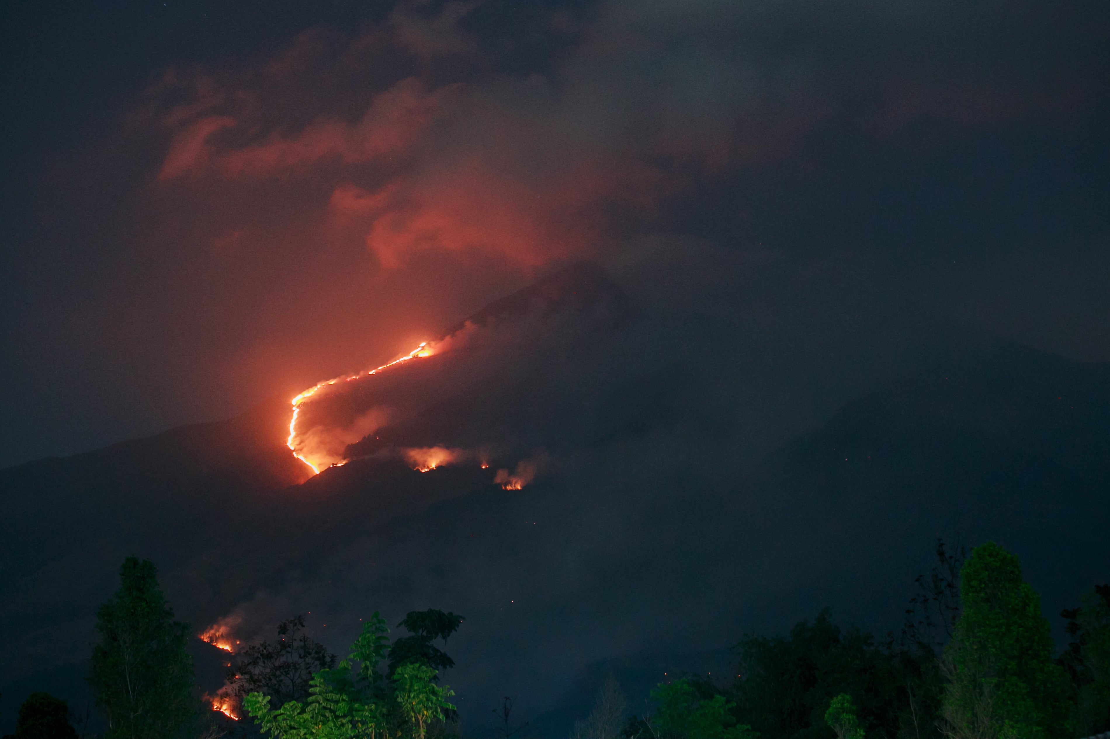
That could lead to a hotter-than-usual summer in the western U.S., potentially worsening the wildfire season in California and Oregon. In the past, it has also often meant a cooler summer in the U.S. South.
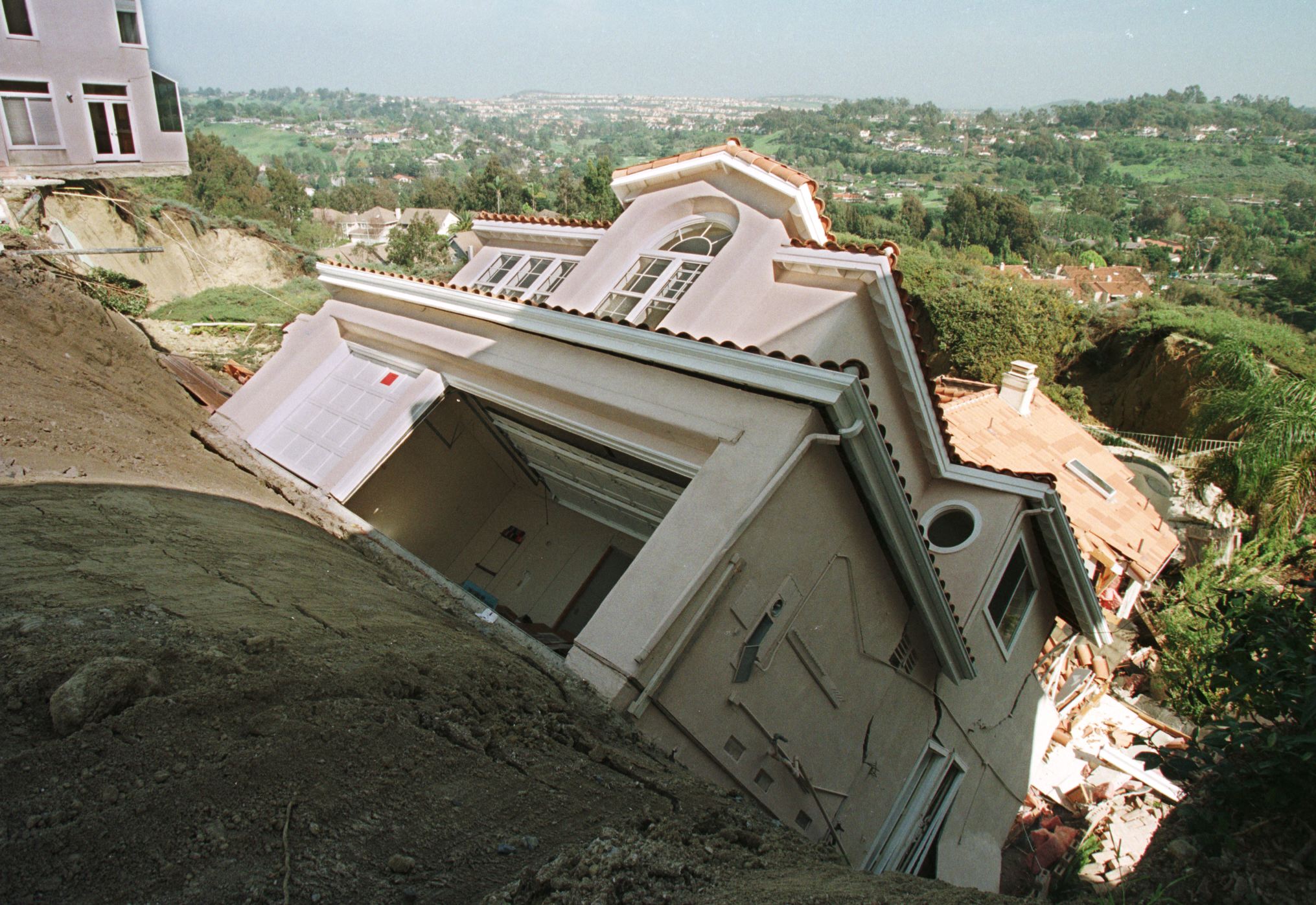
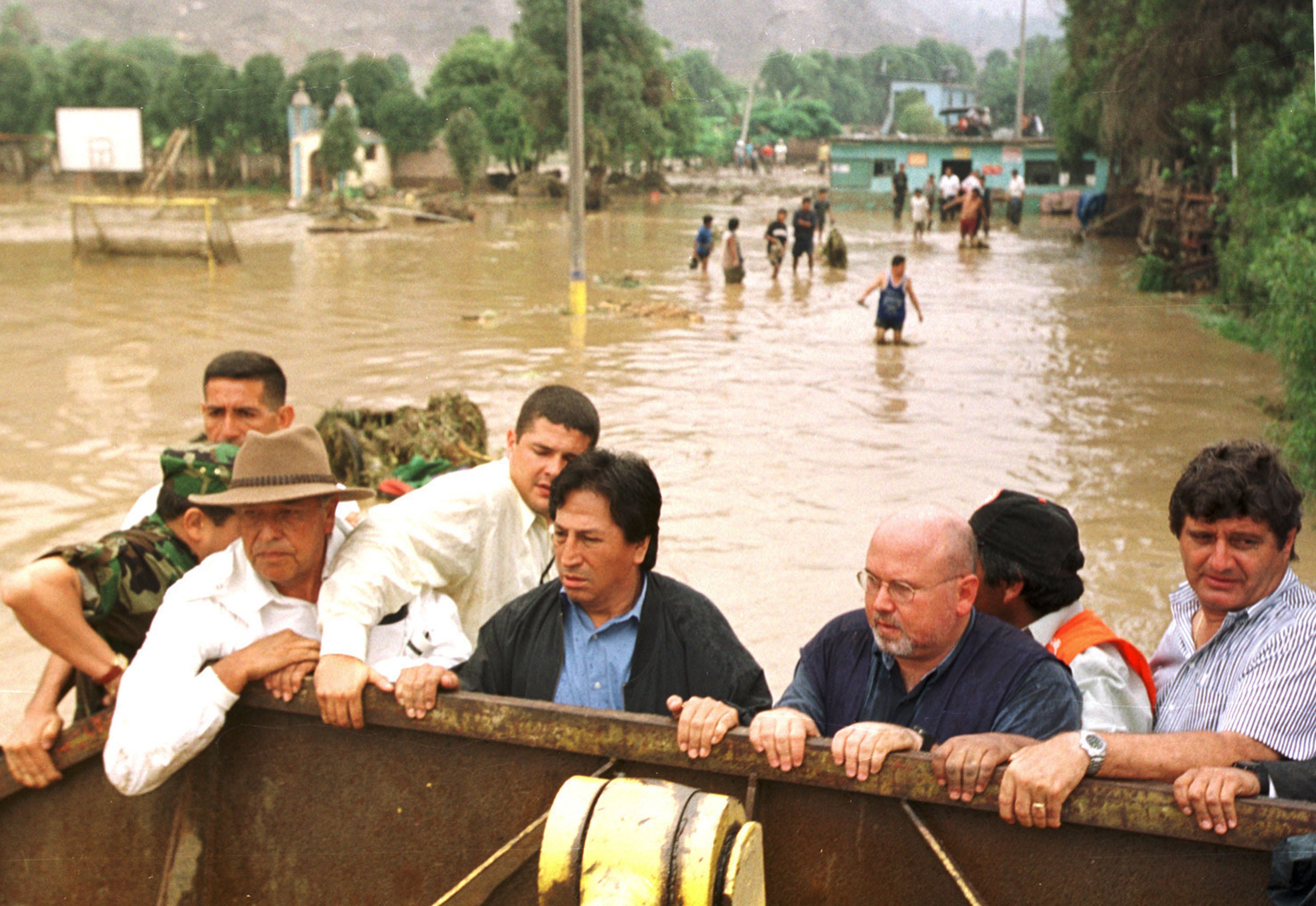
Conversely, Western and Southern winters could be wetter than normal, leading to more snowfall in the mountains and perhaps some relief for the ongoing droughts in many states.
The Midwest might see drier weather, while the Pacific Northwest is likely to be unusually hot.
“El Niño patterns could bring more rain than normal to the Colorado Basin,” said AccuWeather meteorologist Chat Merrill. “The early start to the El Niño can lead to an increase in moisture from the southern Plains to East Coast during summer and fall.”
While hurricanes in the Atlantic generally find it harder to form, they are more active in the Pacific, meaning that Hawaii and east Asia might suffer more storms.
Pacific Islands such as Guam, Hawaii, and American Samoa tend to get drier weather, but the increased chance of cyclones means they may be suddenly lashed by high rainfall.
Extreme weather is more likely overall, with intense heat in tropical countries and potentially widespread droughts around the world.
A strong El Niño would accelerate global warming
If human industrial civilization had not been eagerly warming the world for the past century or two, we could expect El Niño’s extra heat to ultimately dissipate.
But now, scientists fear the phenomenon may lead to a permanent and sudden jump in global temperatures.
“Due to the increasing concentration of greenhouse gases, the climate system cannot effectively exhaust the heat released in a major El Niño event before the next El Niño comes along and pushes the baseline upward again” Defense Department meteorologist Eric Webb told The Washington Post.
Indeed, the El Niño event of 2023/24 reportedly contributed to 2024 being Earth’s warmest year on record.

A super El Niño in 2026/27, according to climate scientist Zeke Hausfather, “would push up our estimate for 2026 global temperatures (though it’s still unlikely to surpass 2024 as the warmest year), and make 2027 very likely to be the warmest year on record.”
That comes after federal meteorologists calculated that the winter of 2025/26 was actually the warmest on record for the continental United States, despite brutal blizzards in the Northeast and Midwest.
The findings underscored how a warmer climate in general can have unpredictable and varied impacts across different regions.
“The East, especially the Northeast, had winter,” said National Oceanic and Atmospheric Administration climate monitoring chief Russell Vose. “In the West, there were certainly places where you could say we missed the winter.”
