

Storm Chandra has brought weather chaos this week with strong winds, heavy rain and snow battering much of the UK, with the Met Office issuing further yellow warnings to follow.
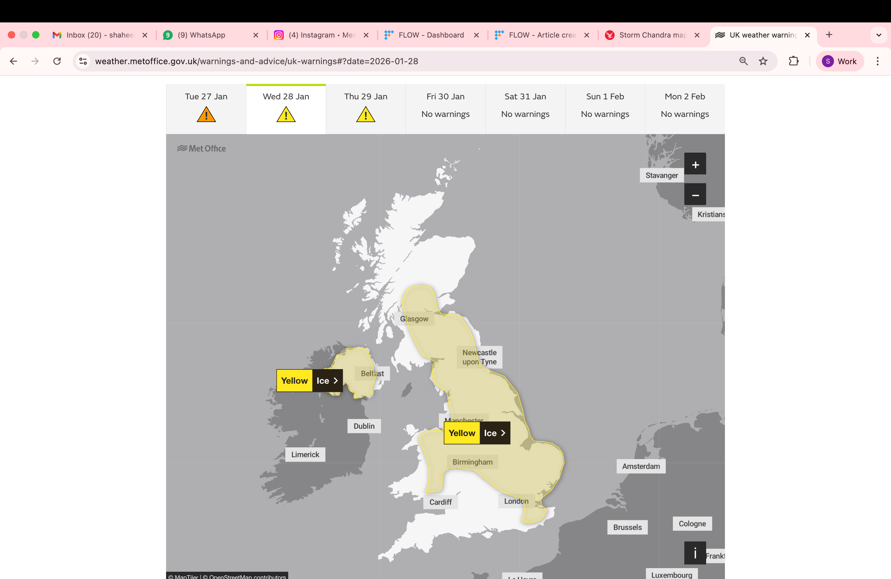
On Wednesday, two yellow warnings for ice have been issued for parts of the UK, which may lead to some disruption. The Met Office has warned that patchy ice is likely to form overnight across parts of Northern Ireland, England and Wales with temperatures set to fall below freezing.
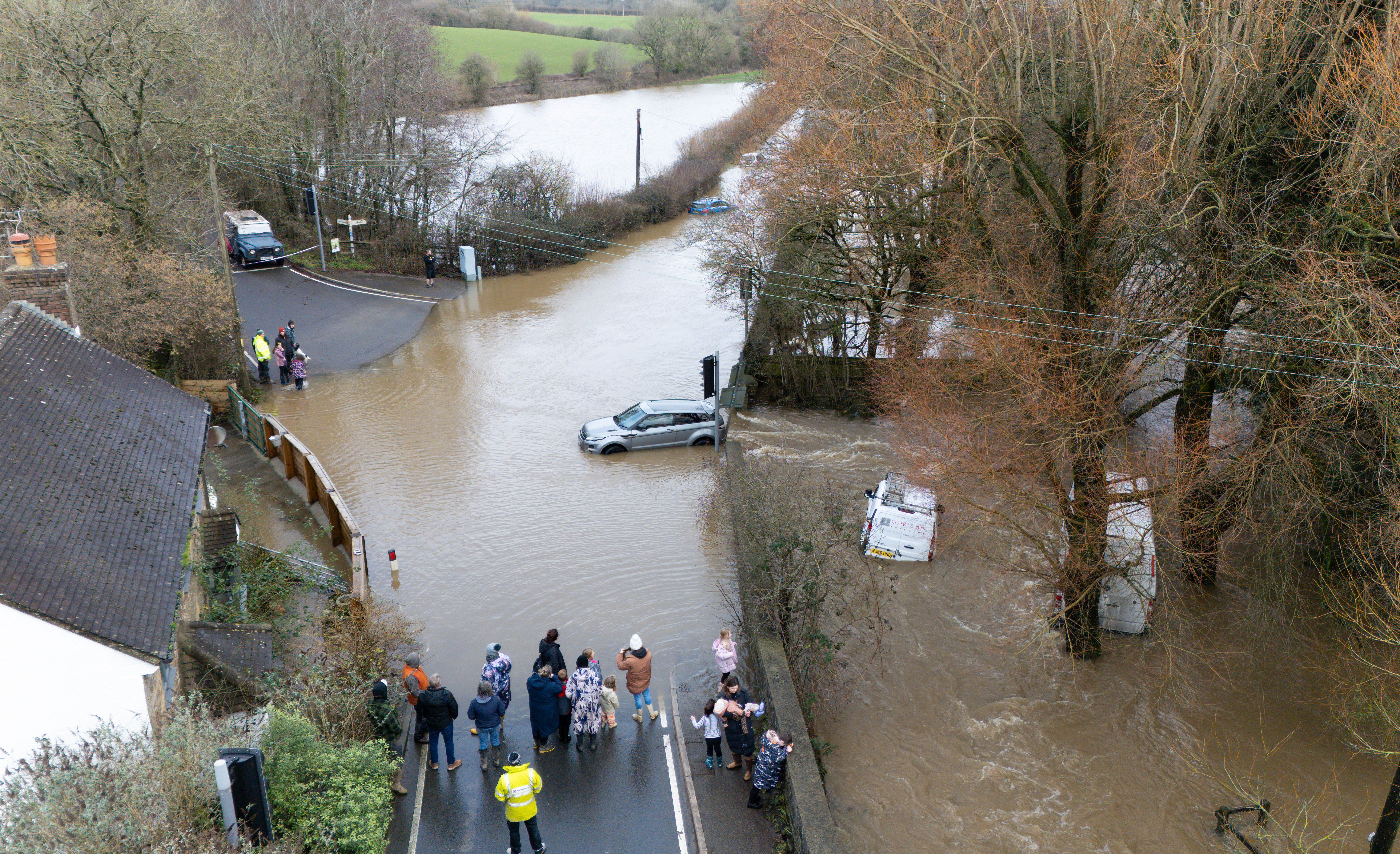
A “major incident” of flooding was declared in Somerset on Tuesday bySomerset Council, the Environment Agency and emergency services who worked closely to support communities impacted by heavy rain and extensive flooding overnight.
Storm Chandra broke several new January daily rainfall records and dozens of flights were cancelled on Tuesday across Scotland and Northern Ireland, due to strong winds. Meanwhile, “horrendous” flooding trapped vehicles and caused travel disruptions and school closures. A woman was even taken to hospital after a tree fell on a car in the Snowhill Road area, Lisbellaw on Tuesday morning.
The Met Office stated: “Clearing skies Tuesday night will allow temperatures to fall below freezing on Wednesday morning and, after the recent very wet weather, icy patches are likely to develop on some untreated surfaces.”
The national weather service has cautioned that icy patches on some untreated roads, pavements and cycle paths may cause some injuries from slips and falls.
Longer journey times and cancellations are expected to impact road, rail, air and ferry services, as well causing some roads and bridges to close.
Driving in these dangerous conditions is not advised and the forecasters suggest staying indoors as much as possible to avoid being vulnerable to injury from high winds.
The regions affected by the yellow weather warning for ice on Wednesday include parts of Northern Ireland, central England, the East Midlands, the east of England, London and South East England, North East England, North West England, Scotland and Lothian borders, Strathclyde, Wales, West Midlands, and Yorkshire and Humber.
Further rain is predicted on Thursday to lead to more flooding and transport disruption in southwest England.
There is a small chance of fast flowing or deep floodwater to cause a danger to life, the Met Office has warned.
The Met Office said: “A band of rain is likely to reach southwest England on Thursday afternoon then spread quickly northeast across the rest of the warning area by evening. The rain is only likely to last for a few hours in any one location but will be heavy at times.
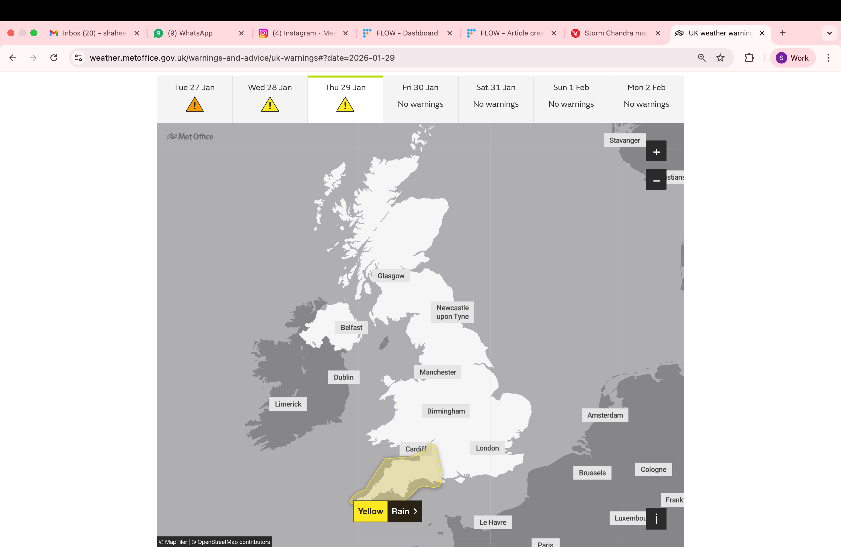
“A further 10 to 20 mm is likely quite widely, and in the wetter spots, particularly across the moors, a further 20 to 40 mm is possible and will fall onto already saturated ground.”
