

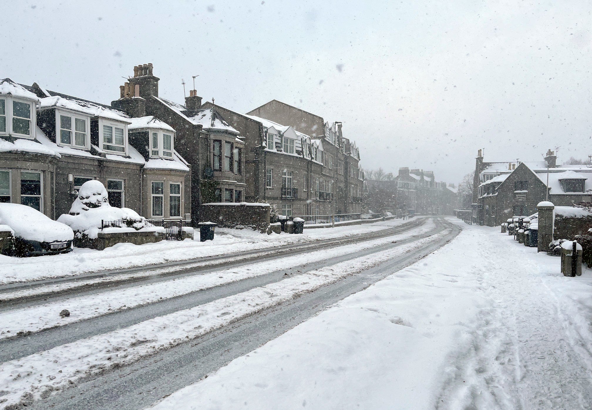
Blizzard conditions are set to hit parts of the UK as numerous amber and yellow winter weather warnings for snow and ice remain in place across the country.
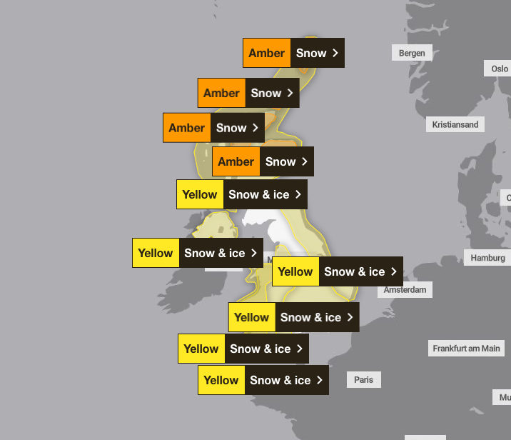
The Met Office issued four amber snow warnings across northern Scotland and six yellow snow and ice warnings across the rest of the UK, stretching from the north of England and northern Ireland down to the south west of England.
Scotland was warned to brace for the worst of the weather as amber snow warnings covered Aberdeen, Aviemore in the Cairngorms, and Ullapool, Ross-shire, through to 10am on Monday, with forecasts of heavy snow, school closures and travel disruption.
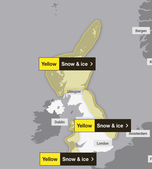
Parts of Scotland can expect up to 30cm of snow accumulation on Monday morning, with strong winds that could cause further drifting of snow and temporary blizzard conditions. A yellow warning for snow and ice covers much of Scotland north of Glasgow, and expires at midnight on Monday.
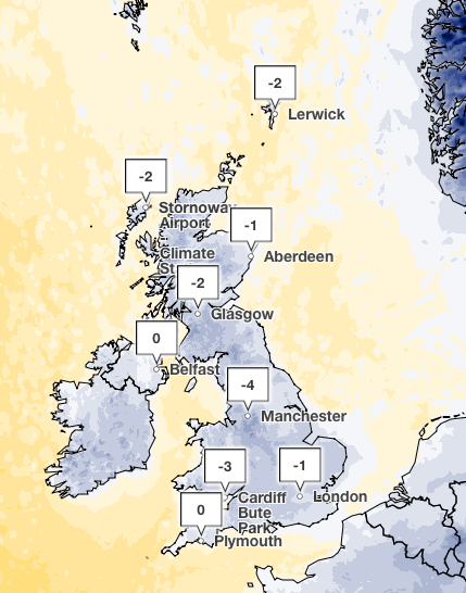
Separate yellow warnings for snow and ice are in place for Wales, Northern Ireland, Greater Manchester, much of the east coast and the south west of England. Parts of Yorkshire and Wales could see 5 to 8cm of snow. The mercury dipped as low as -8C in Cheshire this morning, with temperatures set to peak at 4C in south-west England later on Monday as cold weather continues through the UK.
Matthew Lehnert, chief meteorologist at the Met Office, said: “As we begin the first full working week of the year, we face a range of winter weather hazards with snow showers and ice.
“In the north of Scotland, snow showers are expected to become more frequent on Sunday night with some locations within the Amber warning areas seeing a further 20 to 30cm accumulate by Monday morning.
“Elsewhere in the UK, snow showers, ice and frost are expected at times but milder air will make attempts to spread eastward from Tuesday. This will mean rain becomes more likely in the south, but there is also the possibility of more organised snow along the boundary of the mild and cold air masses. Strong winds could also be a feature later in the week.”
Severe weather conditions have shut hundreds of schools across the UK as the Met Office warned travel could be impacted in affected areas. Regions covered by the amber weather warning could expect travel disruption, and rural communities could become cut off. The forecaster warned flights could be cancelled and mobile phone coverage could be affected.
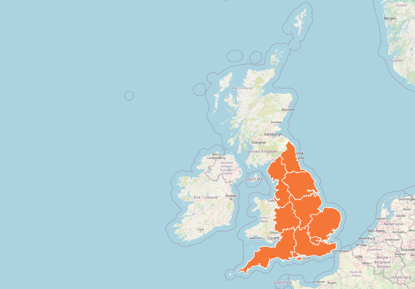
The UK Health Security Agency (UKHSA) has issued amber cold health alerts for all of England until Tuesday, warning there could be significant impacts across health and social care services, including a rise in deaths, particularly among those aged 65 and over or with health conditions.
Dr Agostinho Sousa, head of extreme events and health protection at UKHSA, said: “As the colder weather sets in it is vital to check in on friends, family and neighbours that are most vulnerable.
“The forecast temperatures can have a serious impact on the health of some people, leading to increased risk of heart attacks, strokes and chest infections, particularly for individuals over the age of 65 and those with pre-existing health conditions.”
Yellow snow and ice warnings will also be in place on Tuesday across Scotland until midnight, as well as the east coast and the south west of England until 11am. Sleet is expected in the North on Tuesday morning, moving into the South in the evening, as the Met Office predicts a mixture of rain, sleet and snow will drift across the country with a risk of strong winds.
Met Office five-day weather forecast
Monday
Many places will stay dry on Monday with sunshine. Snow showers will continue across parts of Scotland, Northern Ireland and some coastal counties. Very cold with a bitter wind chill at times.
Very cold at night with a widespread frost and icy stretches. Staying dry and clear in the south, but cloudier in the north as a band of snow moves in.
Tuesday
Another cold day with a mixture of rain, sleet and snow across the north. Drier in the south with sunny skies, before rain, sleet and snow moves in the evening.
Wednesday to Friday
Staying cold with frontal systems pushing in from the west. A mixture of rain, sleet and snow will move across the country at times with a risk of strong winds.

