

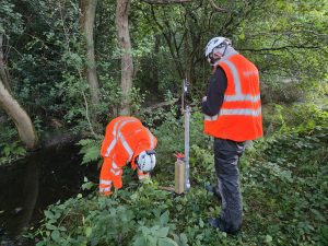
Sensors being installed to gather data in the catchment area
A pioneering project is underway in the Severn Valley that could transform how local communities manage flood risk—using cutting-edge technology to support more natural, sustainable solutions.
The Geospatial Demonstrator Project, part of the Severn Valley Water Management Scheme (SVWMS), funded by Defra, is led by the University of Chester in partnership with Wolf Logic, Severn Partnership, and is managed by Shropshire Council. It focuses on the Habberley Brook catchment, where a range of Natural Flood Management (NFM) interventions are planned.
Using advanced laser scanning and satellite imagery, the team has created a highly detailed digital model of the landscape – 100 times more precise than existing data. This allows experts to identify the best places for interventions such as leaky dams, bunds, hedge planting, and floodplain reconnection, helping to slow and store water naturally.
Dr Andrew Miles from the University of Chester, said:-
“This technology gives us a much clearer picture of how water moves through the landscape and it means we can target flood management efforts where they’ll make the biggest difference.”
Real-time sensors will also be installed to monitor rainfall and river levels, helping to validate the impact of these interventions.
The data will feed into a new mobile app, co-designed with local residents and landowners, offering live updates, interactive maps, and opportunities for community members to contribute their own observations.
Associate Professor Namrata Bhattacharya-Mis, added:-
“This is about putting powerful data into the hands of the people who live and work here. We’re making sure the tools we build are useful, accessible, and shaped by local voices.”
The project’s long-term goal is to create a blueprint that can be used across the wider Severn Valley and beyond – helping other communities benefit from the same approach. By providing clear evidence of NFM’s effectiveness, the project will support future investment in natural flood defences and strengthen local resilience.
Tom Dainty Shropshire Council deputy cabinet member with responsibility for the environment, said:-
“This is a major milestone for the Geospatial demonstrator project and its ability to inform the wider SVWMS.
“I am delighted to see innovation combining with local knowledge to protect our communities and landscapes for generations to come.”
About SVWMS: The SVWMS, is a partnership between the EA, Natural Resources Wales, Powys County Council and Shropshire Council with the intention to tackle flooding, support thriving communities and create resilient environments through sustainable and holistic water management.
People can also keep up to date with progress of the scheme and all the latest news and events by viewing the SVWMS website, which seeks feedback from those with an interest in the scheme.


