


Temperatures are expected to soar as high as 30C this Bank Holiday before the remains of Hurricane Erin bring wind and rain.
The Met Office has forecast highs of 28C for the Bank Holiday Monday to round off a warm weekend which saw peaks of 25C in London.
Cities across the midlands and north east of England, such as Nottingham and Manchester, will see peak temperatures in the late twenties until around 7pm on Monday when temperatures begin to cool off.
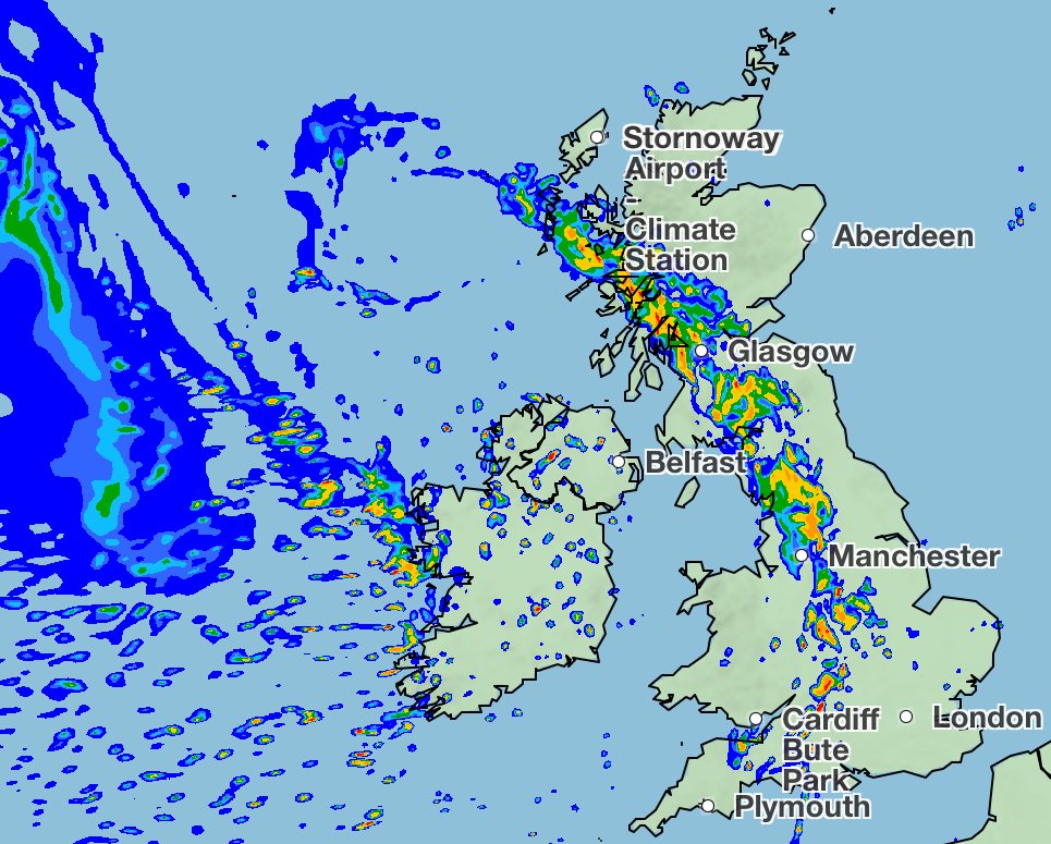
Later on Monday evening, the remnants of Hurricane Erin are set to move in the west of the United Kingdom, bringing rain and wind with it which will continue throughout the week, according to Met Office meteorologist Craig Snell.
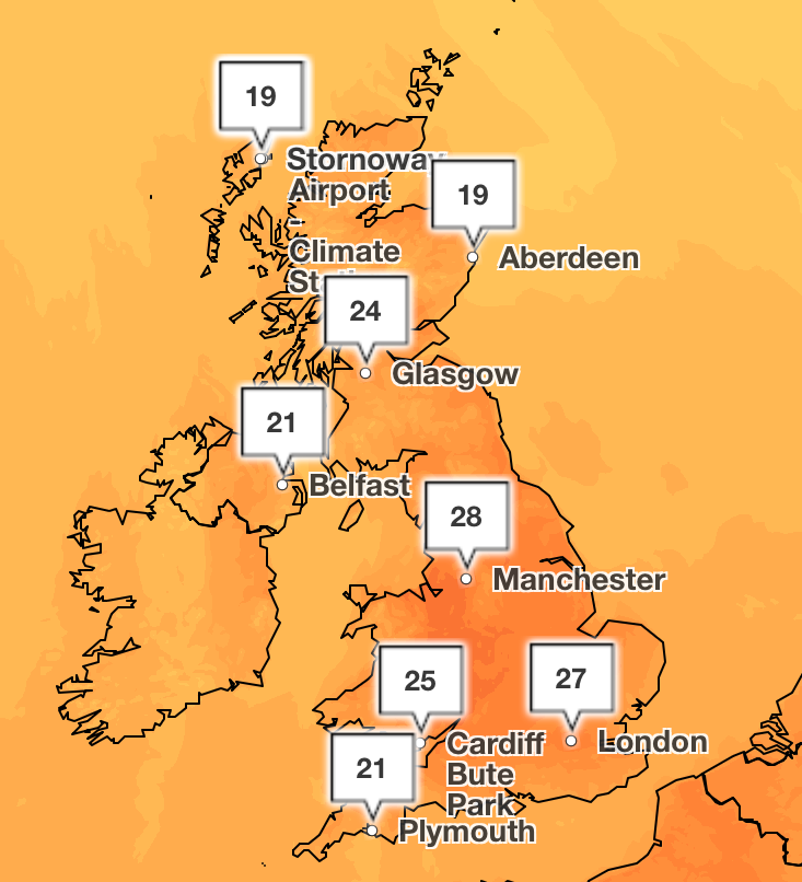
Hurricane Erin’s wind and rain will see temperatures lower to high teens in the north and low twenties in the south for more average temperatures.
Mr Snell said for Monday “it will be largely dry across the UK”, adding: “There will be increasing amounts of sunshine and temperatures continuing to climb.
“On Monday it will be a very warm and sunny picture for most.
“It will start to go downhill and rain will start to move in for Northern Ireland into the afternoon.”
No UK weather warnings are currently in place for the arrival of Hurricane Erin, which tore through the Cape Verde at maximum speeds of 160 mph, as only the last remnants of the storm are set to impact the country.
In just over 24 hours, Erin went from a category one hurricane to a category five, before weakening to a category two storm.
People heading to the beach on Monday or Tuesday have been advised to head to ones with life guards as big waves are set to arrive.
From Tuesday onwards spells of rain will be moving across all parts of the country, and it will be wettest in the west, Mr Snell said.
He added: “It will be heavy at times in the west, but at the moment we’re not expecting too many impacts, and it may for farmers or anyone who needs the rain be welcome.”
On Wednesday, a band of rain will go across the whole country, and low pressure will remain until the weekend with further spells of rain.
Today:
Warm or very warm for many, with plenty of sunshine. Cloud increasing in the far west during the day, with rain arriving across Northern Ireland late afternoon and western fringes of the rest of the UK by evening. Rather breezy.
A band of rain, heavy at times, will move eastwards through the evening and overnight. Scattered blustery showers following, most frequent in the west. A warm night in the east.
Tuesday:
A day of sunny spells and scattered showers. Showers most frequent in the northwest, some heavy with the risk of thunder. Generally cooler, but still feeling warm in the sunshine.
Wednesday to Friday:
Frequent showers, as well as some longer periods of rain expected. Showers heavy at times, with hail and thunder. Often breezy. Cooler, but feeling pleasant in any sunnier moments.


